
Pondicherry, established in the seventeenth-century as a trading outpost of the French East India Company, evolved into France’s most enduring colonial settlement on the Coromandel Coast. Though controlled at various intervals by the Dutch and the British, it remained under French administration for nearly 280 years, from 1674 to 1954. This prolonged presence shaped not only its administrative structures but also its architectural and cultural landscape. The Francophone imprint continues to be visible in its pastel-coloured façades, tree-lined boulevards, French street names, and even in civic symbols such as the red kepis (caps) worn by local policemen.
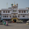
A walk along Rue Romain Rolland, Rue Dumas, or Rue Suffren, near the Sri Aurobindo Ashram and along the Beach Promenade, offers insight into a historic layout shaped by both colonial preferences and climatic adaptation. Landmarks such as the Manakula Vinayagar Temple, Eglise Notre-Dame des Anges, the Basilica of the Sacred Heart of Jesus, and the Raj Nivas, formerly the residence of Governor-General Joseph François Dupleix, stand within close proximity. Their coexistence reflects a town formed through layered histories of governance, faith, and commerce.
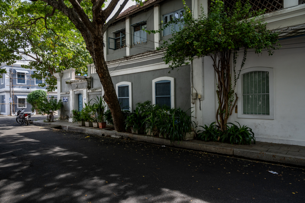
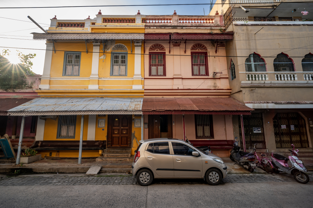
A street in the French Quarter. (Picture Credits: Joseph Rahul)
The Anatomy of the Boulevard
The layout of the Heritage Town remains virtually unchanged since the colonial expansion of the early eighteenth-century. Pondicherry was laid out on a gridiron plan, a geometric system typical of European colonial settlements where streets run at right angles to each other to form rectangular blocks. This rigid architecture was a consequence of the brief period between 1693 and 1699, when the Dutch had taken over Pondicherry. During this time, they drafted a plan for grid-lined streets to replace the previous organic growth. When the French regained the territory in 1700, they carried this plan to completion, creating a "Boulevard Town" circumscribed by four wide avenues that acted as a containment for the colonial experiment.
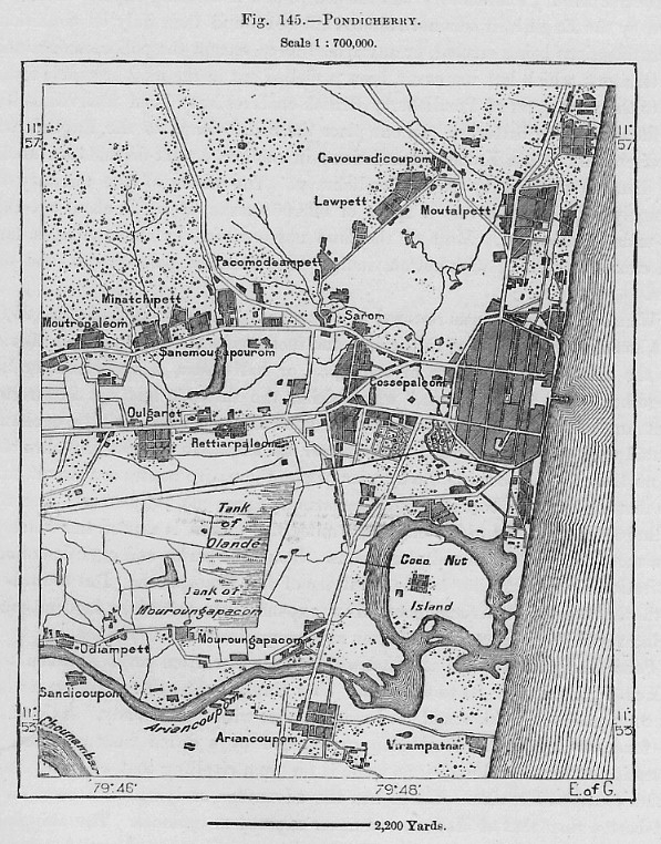
The Boulevard town with its larger context. (Picture Courtesy: John Luffman/Wikimedia Commons)
This geometric order was not merely aesthetic. It embodied European notions of urban control, visibility, and administrative clarity. At the same time, it provided a framework within which local building traditions would eventually find expression.
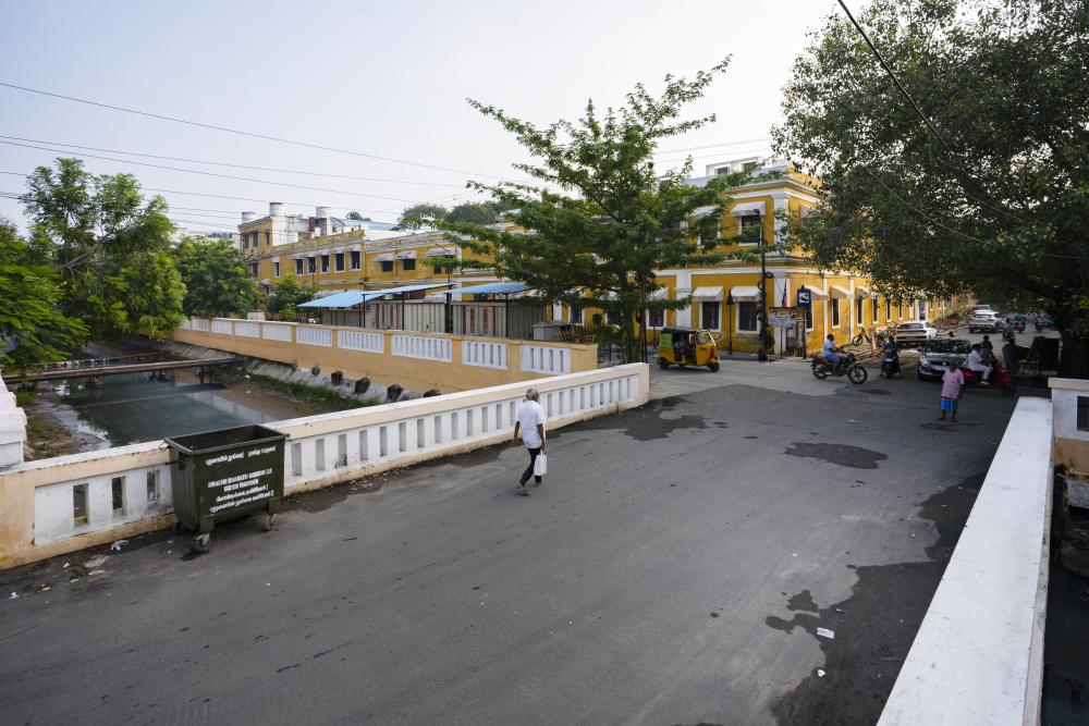
View of the Grand Canal. (Picture Credits: Jubin Bennet)
The city is bisected by the Grand Canal, a feature that originally served as a drainage system but became a stark tool of social engineering. The French planned the Canal as a physical cordon sanitaire to enforce racial and social segregation. To the east, facing the seafront, lies the Ville Blanche (French Quarter), characterized by wide, tree-lined streets and stately villas. To the west of the canal lies the Ville Noire (Tamil Quarter), with a denser street network and traditional row houses organized around narrower lanes. This spatial organization followed a colonial logic of separation, yet a hybrid urban identity evolved over time as the two quarters began to influence one another through trade and domestic service.
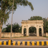
The French Quarter
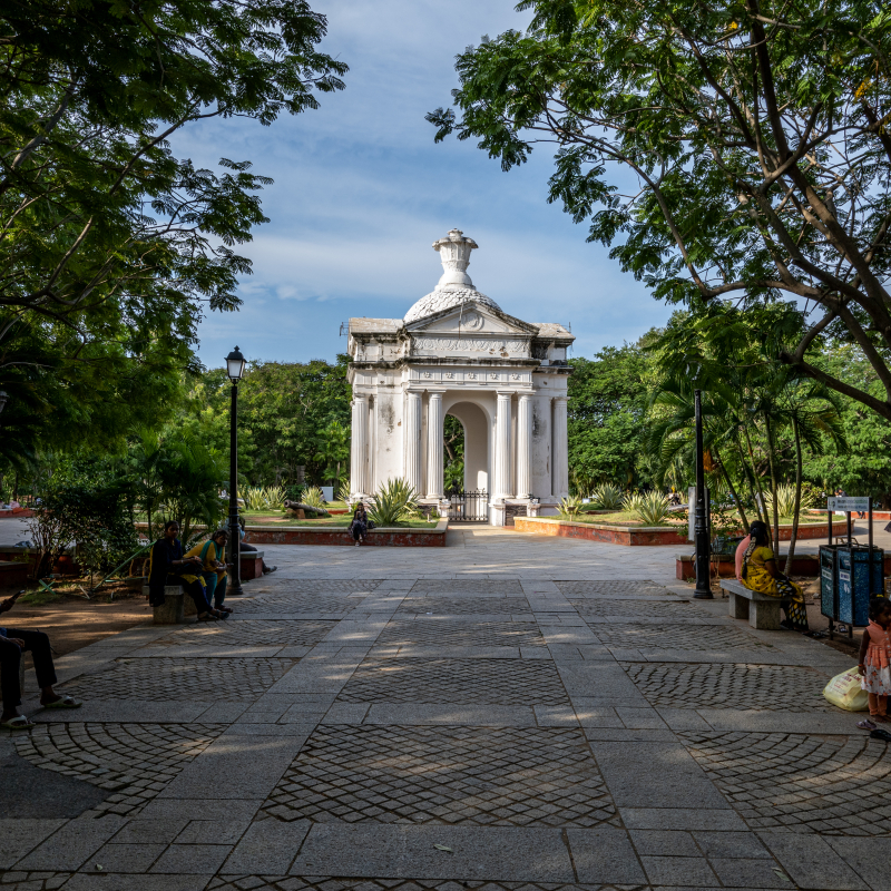
The French Quarter developed along the seafront and around Bharathi Park, which is encircled by stately government buildings set within expansive compounds. Residential villas extend outward from this administrative nucleus, interspersed with institutional structures. Public buildings are typically set within fenced enclosures, projecting authority through scale and spatial openness. Residential structures, by contrast, create continuous wall-to-wall street façades defined by high compound walls.
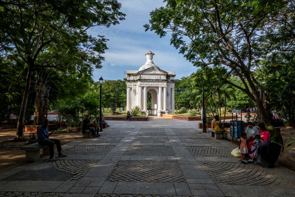
View of Bharathi Park with its central Aayi Mandapam. (Picture Credits: Joseph Rahul)
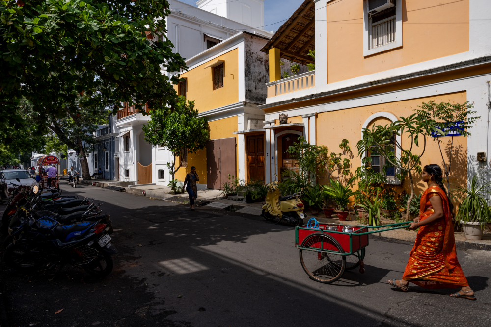
Houses in the French Quarter. (Picture Credits: Joseph Rahul)
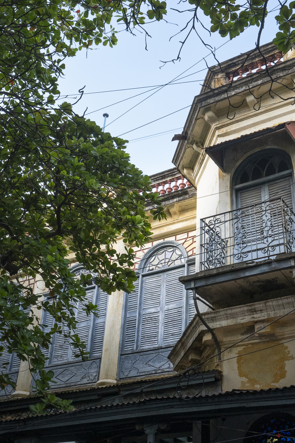
View of louvered windows and window shades. (Picture Credits: Jubin Bennet)
These façades are articulated by vertical pilasters and horizontal cornices, often punctuated by flat or segmental arched openings fitted with louvered wooden shutters. Wooden balconies supported on iron brackets and parapets with restrained ornamental features define the skyline. The street elevation often presents a composed and formal exterior, while the interior spaces are more elaborate.
Although inspired by French prototypes, these houses were adapted carefully to the climate of the Coromandel Coast. One significant modification was the replacement of pitched European roofs with flat terraced roofs, commonly executed in the Madras Terrace system. This responded to local climatic conditions and allowed the terrace to function as a usable evening space. Window shades were constructed in lighter materials such as wood or metal to reduce heat retention and enhance ventilation.
Most residences follow a broadly similar ground plan. A colonnaded portico provides shade and mediates the transition between street and interior. Behind the façade lies a walled garden or interior court that acts as a climatic regulator, allowing air circulation while maintaining privacy. The rooms are marked by high ceilings, tall arched doors and windows, and in two-storeyed houses, gracefully rising staircases. The garden court serves as the central breathing space of the house, ensuring that ventilation and light penetrate deep into the built mass.
The Tamil Quarter
To the west of the canal, the character of the streetscape shifts significantly. The native Tamil town originally developed around a nucleus of temples in the northern section. Streets were laid predominantly along an east–west axis, with back-to-back row houses opening onto them. Continuous wall-to-wall construction persists here, yet the architectural vocabulary differs markedly from that of the French Quarter.
The thalvaram outside Tamil houses. (Picture Credits: Jubin Bennet)
The thinnai outside traditional Tamil homes. (Picture Credits: Sayali Athale)
The most distinctive features of these houses are the thalvaram and the thinnai. The thalvaram is a street veranda, formed by a lean-to roof supported on wooden posts. It extends shelter not only to the household but also to pedestrians, blurring the boundary between private and public space. The thinnai, equipped with masonry benches, functions as a semi-public reception area where neighbours, visitors, and pilgrims are welcomed. These transitional spaces embody a social ethic of openness and hospitality.
Because the streets are long and straight, the thalvarams frequently align to form a near-continuous shaded walkway. These have often been described as “talking streets” due to their intimate scale and the ease of social interaction they encourage. Cornices, pilasters, engraved wooden columns, and ornamental parapets contribute to a cohesive skyline. While houses share common structural principles, individual variations in detailing ensure that no two are identical.
Entry into the house is through a carved wooden doorway leading to the mutram, a colonnaded courtyard that forms the heart of domestic life. Around this space are arranged living quarters, service areas, and ancillary rooms. Some houses contain multiple courtyards. Older Hindu quarters retain simple, single-storeyed houses with country-tiled roofs. Later Hindu and Christian residences developed into two-storeyed forms that reveal increasing colonial influence. On the ground floor, doorways are often simple and ceilings comparatively low; the first floor, however, may incorporate arched openings, decorative plasterwork, capital columns, and stained-glass windows. Prayer rooms, wells, and rear courtyards further articulate the domestic layout.
Two storied structures of the affluent in the Tamil town. (Picture Credits: Joseph Rahul)
The southwest Muslim Quarter presents another variation within the grid. Although integrated into the orthogonal plan, its principal streets are subtly angled to orient mosques towards Mecca. This slight geometric adjustment produces a distinctive inflection within the larger urban order. Houses in this quarter are often more elaborately ornamented and vividly coloured, reflecting a distinct yet integrated cultural presence.
The Franco-Tamil Synthesis
The architectural landscape of Pondicherry cannot be understood as a simple juxtaposition of European and Tamil forms. Instead, it represents a sustained synthesis. Across France’s former colonies, including Indochina, Reunion Island, and Algeria, French architecture adapted to tropical climates through modified materials and techniques. In Pondicherry, however, the interaction went further. Tamil domestic spatial concepts such as the courtyard, veranda, and transitional threshold were absorbed into colonial frameworks. Conversely, European structural and ornamental elements were incorporated into local building traditions.
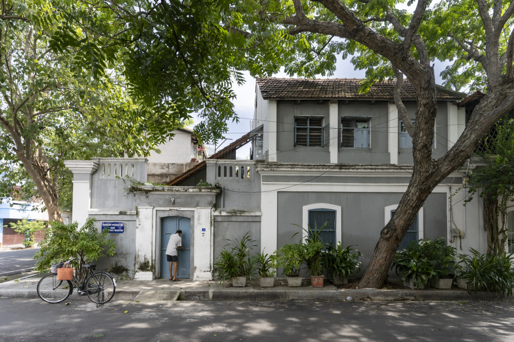
An Ashram owned property in the French town. (Picture Credits: Jubin Bennet)
An Ashram owned property in the French town. (Picture Credits: Jubin Bennet)
An Ashram owned property in the French town. (Picture Credits: Jubin Bennet)
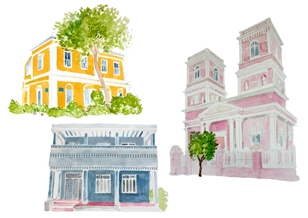
Houses in Puducherry. (Illustration Credits: Jisha Unnikrishnan)
The result is a Franco-Tamil hybrid architecture that evolved gradually, responding to climate, materials, craft traditions, and social exchange. It is this integration of form and function, rather than stylistic borrowing alone, that makes Pondicherry’s built environment distinctive.
The Path Ahead
Pondicherry remains an inhabited historic town that has experienced rapid urbanisation in recent decades. Conservation therefore involves managing growth while safeguarding architectural integrity. Heritage buildings are being preserved using period materials and techniques wherever feasible, and new constructions within notified precincts often adopt compatible scale and vocabulary to maintain heritage streetscape continuity.
The INTACH Pondicherry Chapter has played a significant role in documenting, grading, and advocating for the protection of the Boulevard Town and its surrounding historic precincts. Through detailed listing exercises, advisory guidelines, and engagement with local authorities, the Chapter has helped frame conservation as a process of managing change rather than freezing the city in time. Under existing Heritage Regulations, 245 buildings have been formally notified as protected. Efforts are underway towards recognition as a UNESCO World Heritage City. Yet beyond formal designation, the preservation of Pondicherry’s architectural landscape depends upon sustaining the living patterns embedded within it. The courtyards, shaded verandas, and ordered streets are not relics but active components of daily life.
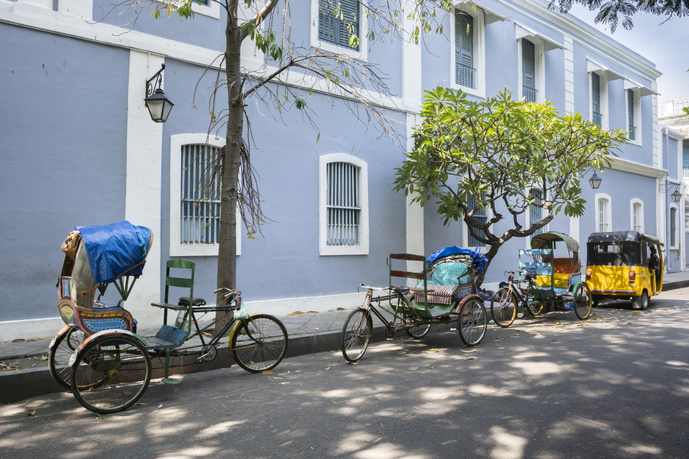
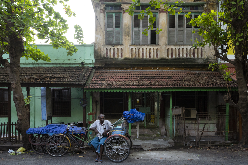
Street in the boulevard town with French architecture and Indian style rickshaws. (Picture Credits: Jubin Bennet)
Pondicherry’s significance lies not only in its French influence nor solely in its Tamil traditions, but in the manner in which these histories converged to produce a coherent urban fabric. The grid and the canal once marked separation. Over time, architecture became the medium through which that division softened, giving rise to a shared and enduring civic identity.
Distinction
|
Feature |
French Quarter (East) |
Tamil Quarter (West) |
|
Orientation |
Sea-facing, oriented for breeze |
Temple-centric, oriented for street life |
|
Privacy |
Hidden behind high garden walls |
Open to the street via the thinnai |
|
Roofs |
Flat-terraced (Madras terrace) |
Country-tiled or lean-to roofs |
|
Social Space |
Private interior courtyards |
Semi-public street verandas (thalvaram) |
|
Hybridity |
Minimal (Colonial adaptation) |
Strong (Franco-Tamil synthesis) |
Further Readings:
Deloche, Jean. Origins of the Urban Development of Pondicherry According to Seventeenth Century Dutch Plans. Pondicherry: Institut Français de Pondichéry, 2004.
Architectural Heritage of Pondicherry: French and Tamil Precincts. Pondicherry: Indian National Trust for Art and Cultural Heritage (INTACH), 2004.
‘Pondicherry: Past and Present’. Pondicherry: Institut Français de Pondichéry. n.d. https://www.ifpindia.org/digitaldb/online/pondicherry/
Chopra, Preeti. ‘Pondicherry’, A French Enclave in India. London: Routledge, 2023.
This essay has been created as part of Sahapedia's My City My Heritage project, supported by the InterGlobe Foundation (IGF).