
Introduction
The term ‘Rajasthan’ was first coined by James Tod, the 19th century British annalist as ‘the collective and classical denomination of that portion of India which is the "abode of [Rajput] princes”' (Kothiyal 2016:3).[1] The colonial construct carried over to independent India, giving us the boundaries of the modern state of Rajasthan. However, its contours do not coincide with a natural geographic region with unambiguous physical boundaries. Three-quarters of the state is the Thar Desert, which forms part of the South Asian desertscape that moves through Pakistani Sindh, Punjab and Balochistan. The remaining one quarter of the state consists of the gently rolling Aravalli range that undulates north and northeast into the plains of the Yamuna and the Chenab rivers, and connects to the Malwa plateau in the southeast.
A direct result of this colonial misconstruction has been the general perception of Rajasthan as a harsh terrain peopled by doughty, battle-scarred Rajput clans. This is more a product of historical fallacy and political circumstance than facts of actual geography or human settlement. Today, the anthropology of Rajasthan is increasingly being studied within the parameters of mobility and migration, and the long-standing yet fluid occupational and cultural patterns set in a landscape that is neither barren nor unrelentingly inimical. The 19th century Rajput-centric paradigm of a chivalric ruling order standing firm in a hostile, sterile desert is no longer the base model for understanding the cultural, political or social development of the Thar region. Instead, the region is seen as part of an interconnected south Asian desertscape, peopled by a vast range of itinerant and settled castes and communities, who have optimised the landscape, the biotic resources, and the locational advantages to their benefit. The purpose of this essay is to examine one aspect of the biotic resources, namely the vegetation, in greater detail.
A Desert Landscape
The state of Rajasthan has four major physiographic divisions: the western desert, the Aravalli hills, the eastern plains, and the south-eastern (Hadoti) plateau. The Aravalli range lies diagonally across the state, and acts as the climatic and geomorphic boundary of the desert.
The focus of this study is the western desert, the area lying to the north and northwest of the state, the arid and semi-arid bioregion—known as the Great Indian Desert or the Thar Desert. To its north lies the Sutlej basin and it is bounded by the Aravalli range on the east and southeast, the Rann of Kutch and the plains of Kathiawar on the south, and the Indus basin on the east.
Discussing its etymology, Tod states:
Marwar is a corruption of Maroo-war, classically Maroosthali or Maroosthan, the region of death . . . the bards frequently style it Mordhur, which is synonymous with Maroo-desa, or when it suits their rhyme, simply Maroo. Though now restricted to the country subject to the Rathore race, its ancient and appropriate application comprehended the entire desert, from the Sutlej to the ocean (Tod, vol. I, 1829:1).
It is the world’s seventh largest desert and a part of Saharasia, which is a stretch of hot and cold deserts in Central Asia and North Africa (Gommans 2002:26).
The word Thar probably derives from t’hul or thal meaning a vast sandy plain. Archibald Adams writing in 1899 described the country north of Jodhpur as one vast sandy plain or thal, broken by sand hills or tebas (Adams 1889:4).[2] Tod describes the major thals as being:
[the] t’hul of Luni, embracing the tracts on both banks of the river, Gogadeo ca t’hul immediately north of Eendovati; the t’hul of Tirruroe, lying between Gogadeo and the present frontier of Jessullmer; the t’hul of Khawur, lying between that of Jessulmer and Barmair and abutting at Girap into the desert of Dhat; and Mallinat’h ca t’hul or Barmair (Tod, vol. II, 1829:241–43).
Within the Thar, there are four sectors on the basis of rainfall and edaphic characteristics (Sharma and Mehra 2009:3).
- The Luni basin, comprising Pali, Jalore, the south-eastern part of Barmer, the eastern part of Jodhpur, the western part of Ajmer, Sirohi and the southern part of Nagaur
- The northern drainage zone, comprising Sikar, Jhunjhunu and northern Nagaur
- The agriculturally rich district of Sri Ganganagar and Hanumangarh adjoining Punjab and Haryana
- The true desert of marusthali, consisting of Jaisalmer, northern Barmer, and the western parts of Jodhpur, Bikaner and Churu districts
Water, or the lack of it, defines the Thar. Seasonal rain comes at the tail end of the monsoons and from occasional western disturbances in winter. The amount of precipitation varies 100 to 400 mm annually, the average being 250 m.[3] High daytime temperatures, high evaporation levels and low groundwater recharge make this a water deficient region. There is only one natural drainage system of the river Luni, and a few seasonal lakes and reservoirs. The fairly recent Indira Gandhi Canal in the north, operative since 1983, has revived agriculture in the Hanumangarh and Ganganagar districts.
The region was not always desolate. If mythology and local legends are to be believed, it was once a well-watered land of rivers and green fields. Historically, Harappan settlements once existed in the area, presumably on the banks of watercourses. The desertification of the Thar is attributed to geological shifts leading to altered flow and silting up of rivers, and the gradual development of sandy plains and salt marshes. Sometime during 2000 to 1500 BCE, the Indus river system may have shifted to the west and the Ghaggar ceased to be a major river and terminated in the desert. Some geological studies suggest that the Ghaggar was once the main drainage system, with the Sutlej and the Yamuna as its tributaries (Kothiyal 2016:30–31).
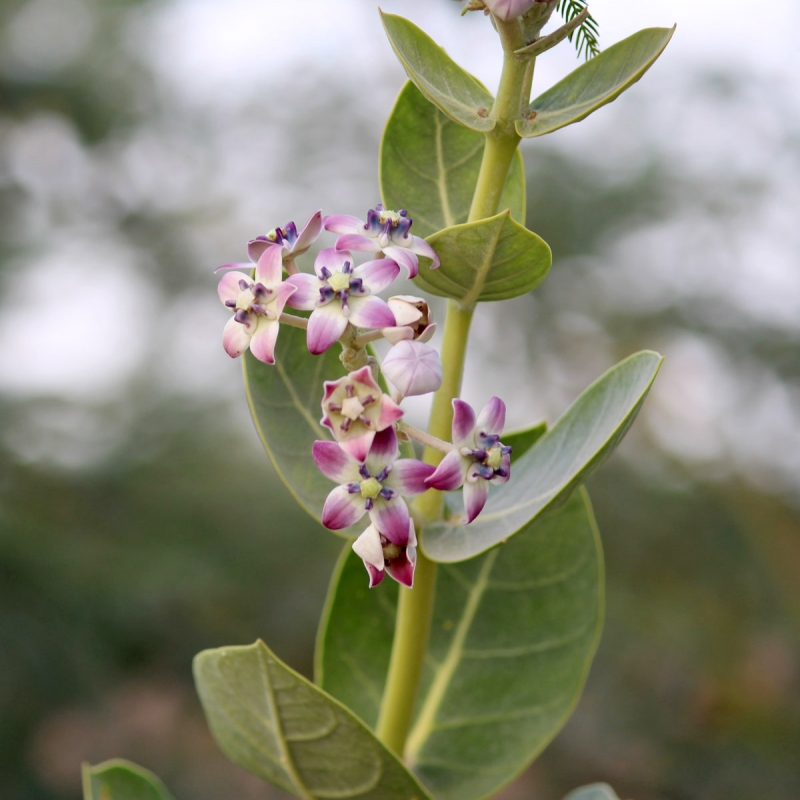
The geological shift also led to a shift from farming to pastoral activities. Forests were cut down for fuel and fodder beyond their regenerative power, while livestock grazing depleted much of the natural vegetation cover over the centuries. M.M. Bhandari summarises the devastating propensities of grazing herds with a Marwari proverb: ‘Oont chhode akaro, bakre chhode kankro’. The camel will eat everything but the aakado (Caliotropis procera) but the goat will leave only pebbles (Bhandari 1978:7).
For the last two millennia, settlements have grown around sources of water and their names reflect this. Ser or sar means water tank or pond. So we have Napaser, Bachaser, Sadosar, Rawatsar, Bhimsar, Dhisar etc. The source of water could be a well or tank, usually with brackish water. Mer means a hill, which usually indicated a stronghold on a strategically higher location such as Jaisalmer, Barmer or Ajmer.
The word jangal came to be used for the lands around Bikaner, to denote ‘a region where the sky is generally clear, and water is scarce, and land abounds in Shami, Karira, Peelu and Kankero’(Sharma 1966:12).[4]
Studying the Flora
Traditional Accounts
Before Independence, knowledge about the biodiversity of the Thar was gleaned from contemporary administrative accounts, both Indian and colonial. The most well-known indigenous account of the region is provided by the 17th-century Diwan of Marwar, Munhot Nainsi, in his two books Munhata Nainsi ri Khyat, and Marwar ra Parganan ri Vigat. The former is a history of Marwar and the latter resembles a gazetteer—both are composite of contemporary information, observation, folklore and poetry. Interestingly, there are references to delineating political space according to local vegetation. There is reference to a boundary settlement in Marwar on the basis of local varieties of grass: one chieftain would get the land with karera (sewan) grass, and the other would get the area with bhurat grass (Kumar 2013:58). A better-known episode is described in the Khyat as ‘aonl aonl rana ra, banwal banwal rao ra’. It refers to a boundary dispute between Rao Jodha of Marwar and Rana Kumbha of Mewar, whereupon it was decided that the region where the babool blooms belongs to Jodhpur and the region where the aonla blooms belongs to the Mewar (narrated in Bhati (ed.) Nainsi’s Vighat, vol. III, 1966:89; referred in Tod, vol. II, 1829:547).
The rough nature of life in Marwar is captured in another proverb:
Bajrika sogra mothan ki dar
Akre ki jhonpri phogan ki bar
Dekhi Raja Man Singh teri Marwar
Bread of bajra flour and dal of moth, huts of aakado and fences of phog;
O Raja Man Singh such is your Marwar (Adams 1889:97).
The 17th-century Dhola Maru ra Duha, a love ballad set in Marwar, is a ‘quasi-historical tale of love, separation, mysticism, memory, battle and death’ (Kothiyal 2016:252). In one of the passages, Dhola’s second wife, Malwani, a princess from Malwa, criticises the land of Marwar:
Maru is colourless . . . where water is to be found so deep in wells that people have to start fetching water at midnight, where there are only shepherds, where there is either famine or an invasion of locusts, where grasses like kareel and untkatarao are regarded as trees, the only shadow to be found is that of phog and aakado and people have to eat seeds of bhurat to assuage their hunger, where there are only rough blankets to wear and people roam about all the time (Swami 1995:185–186).
Colonial Accounts and Beyond
The British in India were intrepid and diligent explorers of every corner of the country, and Rajputana was no exception. The terrain, its peoples and their customs all came under the assiduous scrutiny of British agents and surveyors. One of the earliest reports is by Alexander Boileau, who travelled across Jodhpur, Bikaner and Sindh in 1835. He gives a dramatic account of the sand dunes:
Long and lofty ridges of sand hills follow each other in ceaseless succession as if an ocean of sand had been suddenly arrested in its progress, with intervals of a quarter of a mile, or ever more between its gigantic billows; for after ascending many hundreds along a gradual slope we would suddenly come to a steep descent, when our paths lay across the line of waves; and on other occasions we would move parallel to them with a steep wall of sand on one side and a gentle rise on the other.
He goes on to observe the action of sand drifts and adds that ‘where the sand has become settled it is overrun with a considerable growth of grass and shrubs which tend still more to bind the soil’ (Boileau 1837:52). (Image 1)

Image 1. A.H.E. Boileau, who travelled across Jodhpur, Bikaner and Sindh in 1835, and wrote a detailed account of the geography, peopIe and culture of the region. He was one of the many 19thcentury European surveyors, administrators and agents in Rajasthan (Source: Wikimedia Commons)
In 1874, P.W. Powlett, who was the officiating political agent of the East India Company, observed in the Gazetteer of the Bikaner State:
Bikaner abounds in best cattle grasses . . . ‘ganthil’ a fine grass so called from its top knot (ganth), ranks first, both for the production of wool and ghi . . . ‘sewan’ a rather tall grass is very good for sheep. ‘Kiu’ the chief grass on the banks of the Chappar Lake is particularly good for cattle; ‘daman’ too is very common in the north; other good grasses are ‘karr’, more common in Marwar are ‘narara’ and ‘ganthia’. ‘Bhurat’ is most abundant in the southern part of the state and ranks after those just mentioned (Powlett 1932:30).
Lieutenant Fagan, surveying the area around Bikaner in early 1890s writes:
Bikaner can boast of very scant vegetation. The commonest tree is the jhand or khejre; in the more level and firmer soils the beri is sometimes seen, and the kikar is occasionally met with in the north of Ghaggar; the babul, a stunted kikar, and the phog, are common on the sand hill, especially the latter. The jal, kair and ak are also not infrequently met (Fagan 1893:3).
A concomitant of colonial life was constant battle with the climate and diseases endemic to India. Consequently, the East India Company sent out surgeons to serve in India, qualified in medicine and botany. They applied themselves to the study of the local flora, set up botanical gardens and learned about local cures and applications. George King, Superintendent of the Botanical Gardens at Calcutta, published the first methodical account of the natural vegetation of the Rajputana region in 1879. This was a detailed article in the Indian Forester entitled 'The Sketch of the Flora of Rajputana', based on his experiences as an Assistant Surgeon attached to the Marwar Agency (King 1879:226–235). For many years, this article remained the lone scientific record. In 1899, Archibald Adams published The Western Rajputana States: A Medico-topographical and General Account of Marwar, Sirohi and Jaisalmir, in which he gave a list of 50 species of plants of the desert area (Adams 1889:397–422). Two Jesuit scholars, Father E. Blatter and Father F. Hallberg published a two-volume study of the plants in western Rajasthan in 1921.[5]
Many detailed studies have been undertaken post-Independence to map and identify plants of the Thar, record their growth patterns and prepare clear nomenclatures. In 1952, K. Biswas and R. Sheshagiri Rao noted the need for a proper phytogeographic survey of desert vegetation (Biswas and Rao 1953:411–421). They emphasised the study of autecology of plants, which is the life history of individual species occurring singularly or in association with other species in particular natural surroundings. In 1978, an excellent publication titled Flora of the Indian Desert by M.M. Bhandari consolidated all the previous research and listed 682 species belonging to 352 genera and 87 families of flowering plants. Of these, 69 species were labelled as ‘introduced’ while the rest as indigenous to the region (Bhandari 1978:16).
The Flora of the Thar
Perennials and Ephemerals
Natural vegetation in an arid climate is sparse and consists of perennial and ephemeral plants. Perennial plants are those that over millennia have developed unique features termed xerophytic adaptations that enable them to survive meagre water conditions. The bulk of these are stunted, thorny or prickly shrubs, and permanent herbs that occur in open clump formations at clear intervals. Open grassland areas are dotted with typical desert shrubs. These are all characteristics of ‘desert scrub’ vegetation.
Xeromorphic features include deep roots, hard and fleshy stems, well-developed spines or a covering of hairs, and leaves either absent or coated with wax or hair to prevent excessive evaporation. The structure of the various plants forming the desert’s vegetation shows great variations usually either in stem, root, or leaf characters adopting various methods like succulence, densely hairy, thorny, spiny, cuticular and waxy coatings, sunken stoma, tuberous or bulbous enlargement, deeply embedded and widely extended root system and various other adaptations, all to store as much water as possible and to protect themselves from the scorching heat and rapid evaporation in the desert regions (Biswas and Rao 1953:413). (Images 2, 3 and 4)
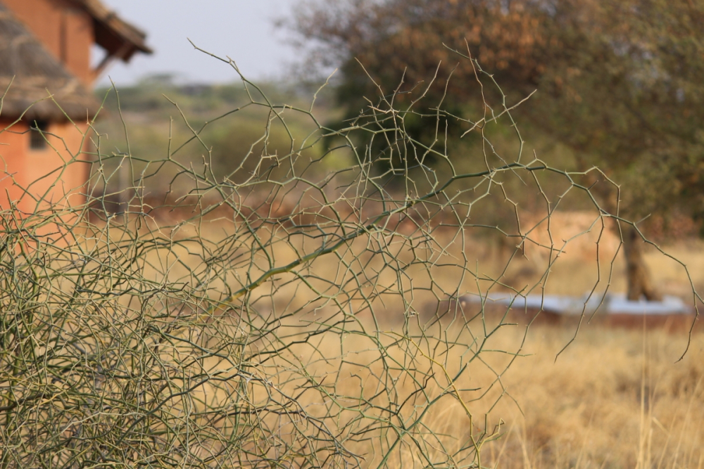
Image 2: Kair bushes with leafless, thin, angular branches. One of the typical xerophytic adaptations in an arid climate is the reduction in size and number of leaves (Photo: Malini Saigal)
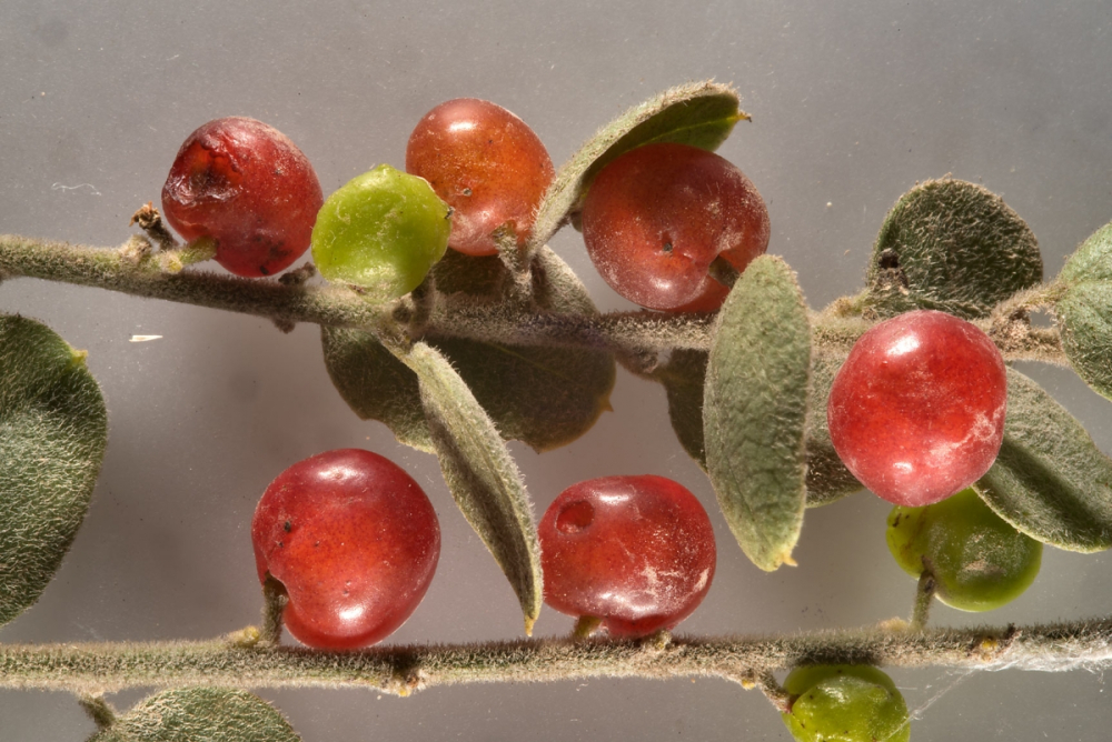
Image 3. Another xerophytic adaptation is fine hairs on leaf and stem surfaces, which breaks the airflow and reduces transpiration (Source: Wikimedia Commons)
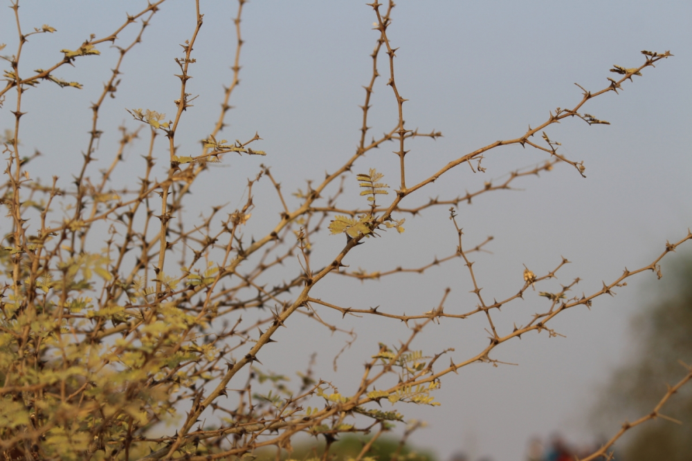
Image 4: Thorny branches of a hardy desert tree. Thorns are a deterrent to animal grazing (Photo: Malini Saigal)
During the short rainy season, the barren visage of sand and rock changes dramatically as masses of ephemerals sprout forth, changing the brown landscape to a vivid green. These are plants that sprout flowers, fruits and seeds within a short span, and then lie dormant till the next rains.
The plants in the desert have to depend on occasional showers at long intervals or on the subterranean water coming from the surrounding area and from the residue of the scanty rainwater that has sunk into the ground below the reach of evaporation. If the water level is so low to be out of reach, the plant becomes dormant, lives (often for years) in the shape of dust-like seeds. Those seeds, which have survived the long sleep, will, on the first showers of any consequence, burst into an intensely active life of very short duration. They sprout, grow, flower, fruit and seed, all within two or three weeks. The particular spot of the desert then becomes covered for a few days with a thin, bright carpet of ephemeral flowers, which disappear almost as quickly as they burst into bloom (Biswas and Rao 1953:413). (Images 5 and 6)
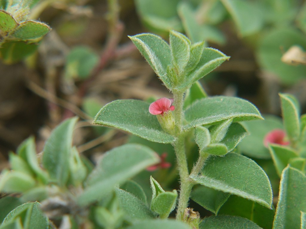
Image 5. Bekario or Heartleaf indigo, a pretty ephemeral that blooms with the rains (Photo: Dinesh Valke, Wikimedia Commons)
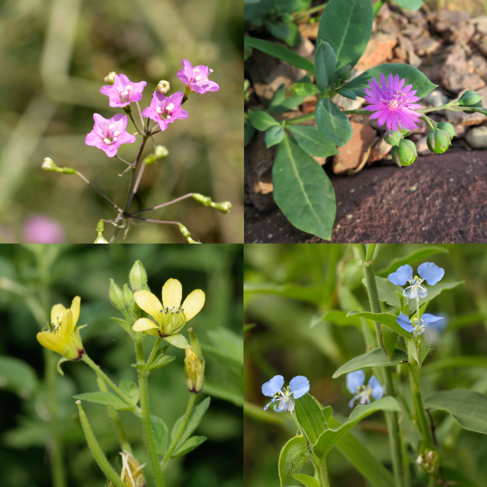
Image 6. The desert also blooms, especially in the rainy season. (Photos: Pradip Krishen)
Sub-habitats
In general, while looking at the vegetation of the Thar, it is possible to consider several sub-habitats:
- Sandy habitats—which constitute the largest area, dominated by sand dunes and gravel plains
- Hills and rocky outcrops—which are the isolated hills and rocky outcrops of the Aravalli edge
- Saline tracts—or saline depressions
- Aquatic habitats—around canals, tanks and reservoirs, including the Indira Gandhi Canal, ponds and other swampy areas
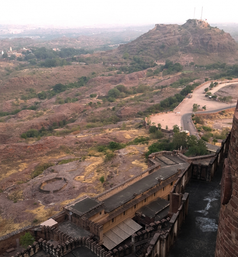
Image 7: Rocky hills around Jodhpur, typical landforms of the region (Photo: Malini Saigal)
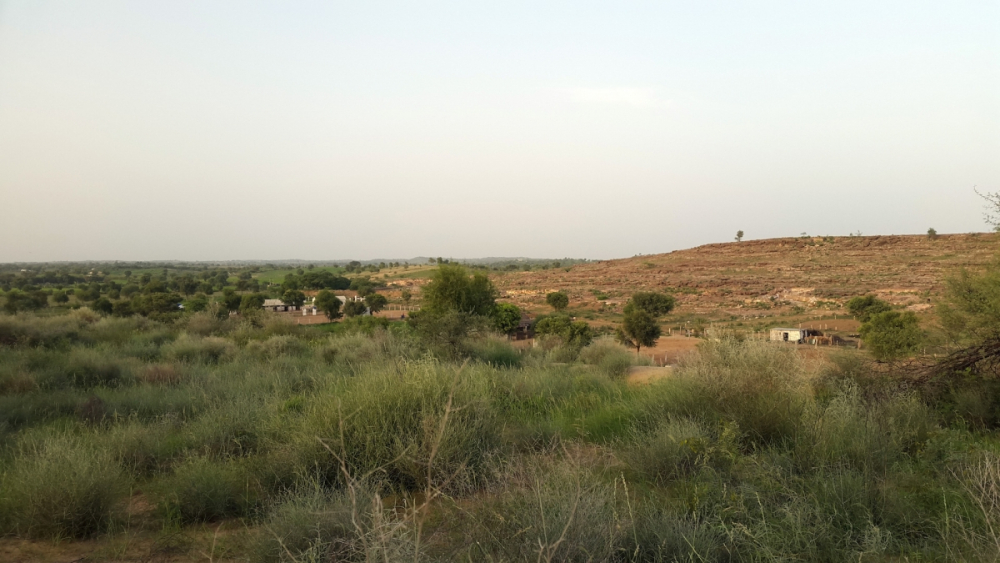
Image 8: Sand dunes and rocky ridges interspersed with cultivated fields is a common sight in the districts of Ajmer, Jodhpur, Barmer and Nagaur (Photo: Malini Saigal)

Image 9: Gravelly terrain with aakado and thor is a common sight along the Jaisalmer highway (Photo: Malini Saigal)

Image 10: Sandy plains and dunes stretch westwards in the Desert National Park beyond Jaisalmer. This is a landscape called 'roee' consisting of grasses and hardy bushes (Photo: Malini Saigal)
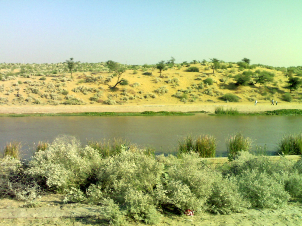
Image 11: The Indira Gandhi Canal near Bikaner (Photo: Wikimedia Commons)
Desert plants that grow on sand are called psammophytic, those that grow in salt-water depressions are called halophytes and those clinging to rock are called lithophytes. These are not distinct boundaries, and most species are found in all of them, though the same species of a tree becomes more stunted and thorny as one moves from gravelly plains to rockier or sandier areas. Many species act as sand stabilizers and check expanding desertification.
Sand dunes form 52 percent of the desert. They extend in long, more or less parallel lines sometimes up to three kilometres, varying from 15 to 30 metres in height. Their chief characteristic is their shifting nature, due to a westerly wind action, giving them a rippling effect like sand on seashore. Seed germination is very difficult on shifting dunes, and so only the hardy psammophytic species gain a foothold in the sand. Plant associations consist of hardy perennials with ephemerals in intervening spaces. Dominant perennials include Crotalaria burhia, species of Aerva (bui or desert cotton), Cympopogan martini (motio grass), and Leptadenia pyrotechnica (khimp). The crests of the sand dunes are colonized often by Lasiurus sindicus (sewan), which is a nutritive quick-growing perennial grass. Stabilized dunes are covered mainly by Capparis decidua (kair), Calotropis procera (aakado), Calligonum polygonoides (phog), Acacia senegal (kumatiyo), Lasiurus sindicus (sewan) and Aristida adescensions. Of these, Calotropis procera and Indigo argentea are ‘typical dune pioneers’ with their fast growing thick, extended woody stems and deeply penetrating taproots. Cyperus arenarius acts as an excellent sand binder due to its stolons that bury deep in the sand, preventing the advance of sand dunes. Some species that resist being overtaken by sand are the bush-forming Acacia jacquemontii, Capparis decidua and Calligonum polygonoides.
Gravel and sand plains, formed by the sorting action of wind, cover a large portion of the region. The gravelly soil supports a large variety of grasses in Dicanthium-Lasirus-Cenchrus varieties, often to be found together. Most of the desert trees and shrubs belong to this habitat. These include Prosopis cineraria (khejari), Salvadora oleoides (kharo jaal), Acacia senegal (kumatiyo), Maytenus emarginata (kankero), Capparis decidua (kair), Tecomella undulata (rohira), and species of Zizyphus (bordi). Many ramblers are also observed such as Coccicinia grandis and Dactyliandra welwitschii.
Rocky hills and outcrops support the same kind of vegetation in general, but there is a preponderance of Euphorbia caducifolia (thor) along with Balanites and Anogeissus. Commiphora wightii (guggal) is another common plant here. The arboreal varieties on rocky slopes tend to be stunted and gnarled. Euphorbia caducifolia is a characteristic lithophyte of the Thar that grows in dense shrubberies supporting many other climbers and twining plants within.
Saline tracts spread throughout the desert, notably across Talchapar, Didwana, Pachpadra, Lunkaransar and Kuchaman, are covered with halophytic vegetation. The major grasses in these depressions are Eleusine compressa, Eragrostis ciliais and Dactyloctenium aegyptium, Suaeda fruticosa, Tamarix troupii, Sesuvium sesuvioides, Trianthema triquetra, Zaleya redimita, Zygophallum simplex, Salsola baryosma, Cressa cretica, Haloxyon recurvum, Haloxylon salicornicum, and Portulaca oleracea.
Tanks and natural lakes with a rocky substratum support a variety of aquatic vegetation like Najas welwitschii, Hydrilla verticalata, Vallisneria spiralis and P. crispus. On the margins and dry beds are found Heliotropium supinum, T. occulta and Eclipta prostrata.
Communities and Conservation
Sacred Groves
Apart from the above sub-habitats, there are protected sacred groves, called orans that are usually located around a source of water on the edge of settlements. They were sites of religious practice, so grazing and loping trees for firewood or timber was forbidden (except in times of famine). As a result, these become storehouses of plant genotypes, especially of keystone species that are needed to understand and sustain biodiversity of the area, and are also culturally invaluable to village communities around. They are the nurseries for Ayurvedic and folk medicine. Plant associations that are integral to the ecological balance of a vegetation zone are better preserved in orans than in state protected forests where monocultural plantation has been carried out to the detriment of the area.
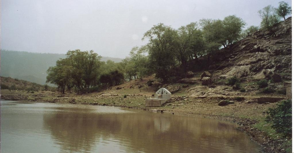
Image 12: An oran or sacred grove around a water body near Ajmer (Photo: Wikimedia Commons)
Orans are usually located around a water resource—a spring, pond or stream—and also serve to recharge ground water as a forested region naturally attracts precipitation. (Image 12) In a region prone to water scarcity and droughts,[6] orans are a lifesaver for humans and livestock. In 1897, the first Inspector General of Forests in India, Sir D. Brandis, noted that sacred groves ‘were very numerous. I have found them in all the Provinces . . . In the dry region sacred groves are particularly numerous in Rajputana’ (Singh 2016:25). The National Environment Policy 2006 has stated sacred groves to be laboratories for the evolution of wild species and the repositories of significant genetic and ecosystem diversity. A recent study notes that there are 3,164 documented sacred groves in Rajasthan, known variously as orans, jogmayas, kenkari or malvan (Singh 2016:25). They can be dedicated to a clan goddess or kuldevi (Bankal, Karni, Hinglaj, Nagnechi, etc.), to a folk hero (Ramdevra, Pabuji), to a local god of Vaishnavite or Shaivite affiliation (Bhaironnath, Gangapuri, Balaknath) or serve as a memorial or samadhi to a local hero/martyr (Bhumiyaji, Mandanji, Kenaji, etc.).
A study by anthropologist Ann Grodzins Gold notes that:
Deities’ domains—the lands called bani . . . were areas where human beings felt constrained to refrain from exploiting the environment, and moreover where they expected that environment to be pleasant. Environmental deterioration within any divinity’s boundaries would surely be displeasing to that deity, and therefore, if it occurred, would be taken as a sign of waning powers. For, persons who violated a potent deity’s proscriptions, by accident or deliberately, were likely to receive parcya or proofs . . . Perpetrators of infringements on the inviolability of deities’ domains might bring a variety of unpleasant experiences upon themselves (Gold 1989:212).
Village tales claim that these punishments could range from sickness, acute pain, blindness or even death, clearly acting as a deterrent to poaching or foraging, and thus preventing the degradation of these groves.
Religious practices
While sacred groves are part of a long-held instinctive community conservation tradition, there are also other religio-cultural practices that protect trees. Mythology and Brahmanical tradition is replete with instances of tree worship and tales of the sacred power of certain trees, notably the pipal, badh, and the khejari. The last is very significant to the Rajputs as it features in both the Ramayana and the Mahabharata as a repository of weapons.[7] Khejari pujan or the worship of the khejari tree is part of the Dussehra ritual in Rajasthan. A study by INTACH in Marwar notes several other pujas associated specifically with trees such as worship of the pipal tree every full moon; worship of the banyan on amavasya or the darkest night of the lunar month; and the festival of amla navami in autumn celebrating the amla or Indian gooseberry (Nagar and Tanwar 2000:33).
Each of the Rajput clans have a kulvriksha or a clan tree, that they are sworn to protect. For example, the Rathores have the neem (Azarachta indica), the Chauhans have the kachnar or jhijyo (Bauhinia variegata), the Panwars have the kadamb (neolamarckia cadamba), and the Bhati have the pipal (ficus religiosa). These are not necessarily trees that are native to Rajasthan, but perhaps hark back to the place of origin of these clans in Kanauj or Malwa (Sharma 1999:215–220).
The Bishnoi tribe of the Jodhpur region follow stringent conservational methods in the use of natural resources. Their religion prohibits killing animals or cutting trees. Legend has it that 294 Bishnoi men and 69 women led by Amrita Devi sacrificed their lives to save the khejari tree in 1778. This led to a royal order that prohibited the cutting of any tree in a Bishnoi village (Thapar 1997:179).
Threats to Biodiversity
The fragile ecosystem of the Thar region is under pressure from a growing population, changing patterns of local climate, and an evolving socio-economic landscape. All of these have played their part in denuding or modifying local vegetation. The indigenous species have traditionally provided food, fodder, fuel, medicine and shelter to a largely pastoralist and herding population. (Link to Arna Jharna article) The main threat today is overgrazing and the dying out of species like phog, which are natural sand binders, and this has led to advancing desertification. In addition, a non-indigenous variety of acacia called vilayati babul or baanvalia has been widely planted in recent decades with disastrous consequences, as it does not provide either fodder or act as a useful sand binder. It is a thorny shrub first introduced a century ago from Central America and is now a major pest to native flora. Similarly, species like the water hyacinth (bengal kino) have invaded local water bodies (Bohra and Mishra 2012:17–20). Indigenous grasses like sewan (lasirus sindicus), which are under threat by overgrazing, have been replaced by short-lived annuals, which are poorer in quality. Once present in large numbers, the rohira tree (Tecomella undulata) also known as the desert teak, is now vastly reduced in its free state.
The khejari is invaluable to the Thar communities as it is an amazingly hardy, arid zone tree. It also enjoys a somewhat better protected status among the community. However, climate change has brought about seasonal changes in its flowering/fruiting cycle. These are being studied for their impact on food and fodder requirements (Ratha Krishnan and Jindal 2015:1980–87).
The Rajasthan State government has designated protected areas such as the Desert National Park to conserve faunal and floral biodiversity. There are also watershed management programmes such as the Desert Development Programme to check desertification.
In recent years, a remarkable initiative in understanding the biodiversity of the Thar has been made by the Rao Jodha Park in Jodhpur. Created in 2006, the park occupies 72 hectares of a rocky hillside below the Mehrangarh Fort in Jodhpur. It has recreated the local ecology and contains 250 plant species and a dozen microhabitats to demonstrate the plant ecology of various parts of the Thar. (Link to plant listing and video)
Further Reading
Adams, Archibald. 1889. The Western Rajputana States: A Medico-topographical and General Account of Marwar, Sirohi and Jaisalmir. London: Junior Army & Navy Stores.
Bhandari, M.M. 1978. Flora of the Indian Desert. Jodhpur: Scientific Publisher.
Bhati, Narayan Singh, ed. 1966–74. Munhot Nainsi ri Likhi Marwar ra Paraganan ri Vigat, Vols I–III. Jodhpur: Rajasthan Oriental Research Institute.
Biswas, K. and R. Sheshagiri Rao. 1953. ‘Rajputana Desert Vegetation’. Proceeds of the National Institute of Science:411–21.
Blatter E. and F. Hallberg. 1918. ‘Flora of the Indian Desert’. Journal of the Bombay Natural History Society, 26:218–46
Bohra, N.K., and D.K. Misra. 2012. ‘Endangered Species of the Thar Desert’, MFP News, Vol. XXII, No 4:17–20
Boileau, A.H.E. 1837. Narrative of a Tour Through Raiwara Embracing the Princely States of Jaiselmer, Jodhpur and Bikaner in 1836. Calcutta: Baptist Mission Press.
Cunningham, Alexander. 1889. The Ancient Geography of India. London: Trubner and Co.
Fagan, P. J. 1893. Settlement Report of Bikanir.
Gold, Ann Grodzins and Bhoju Ram Gujar. 1989. ‘Of Gods, Trees and Boundaries: Divine Conservation in Rajasthan.’ Asian Folklore Studies 48.2:211–29.
Gommans, Jos. 2002. Mughal Warfare, Indian Frontiers and High Road to Empire, 1500–1700. London: Routledge.
King, George. 1879. ‘Sketch of the Flora of Rajasthan’. Indian Forester, Vol. 4: 226–35.
Kothiyal, Tanuja. 2016. Nomadic Narratives: A History of Mobility and Identity in the Great Indian Desert. New Delhi: Cambridge University Press.
Kumar, Mayank. 2013. Monsoon Ecologies: Irrigation, Agriculture and Settlement Patterns in Rajasthan during the Pre-Colonial Period. New Delhi: Manohar Publications.
Krishen, Pradip. 2011. The Small Plant Guide to Rao Jodha Desert Rock Park. Jodhpur: Mehrangarh Museum Trust.
———. 2011. Jungle Trees of Central India. Delhi: Penguin Books.
Nagar, Mahendrasingh and Mahendrasingh Tanwar. 2000. Jodhpur Shahar ke Aitihasik Smarak ka Dastavejikaran. Jodhpur: Mehrangarh Museum Trust and INTACH.
Powlett, P. W. 1874. Gazetteer of the Bikanir State. Bikaner: Government Press.
Ratha Krishnan, P. and S. K Jindal. 2015. ‘Khejari: The King of the Indian Thar Desert.’ Current Science 108.11:1980–87.
Sharma, Dashrata. 1966. Rajasthan through the Ages. Bikaner: Rajasthan State Archives.
Sharma, Dharampal. 1999. Mewar Sanskriti evam Parampara. Udaipur: Pratap Shodh Pratisthan.
Sharma, K. K. and S. P. Mehra. 2009. ‘The Thar of Rajasthan (India): Ecology and Conservation of a Desert Ecosystem.’ C. Sivaperuman et al. (eds.). Faunal Ecology and Conservation of the Great Indian Desert, 1–11. Berlin Heidelberg: Springer-Verlag.
Singh, G. 2016. Sacred Groves of Rajasthan: Threats and Management Strategies. Jodhpur: Scientific Publishers.
Swami, Narottam Das, ed. 1995. Dhola Maru ra Duha. Jodhpur: Rajasthani Granthaghar.
Thapar, Valmik. 1997. The Land of the Tiger: A Natural History of the Subcontinent. Berkeley: University of California Press.
Tod, James. 1829. Annals and Antiquities of Rajast’han or, the Central and Western Rajpoot States of India, Vols I & II. Ed. Douglas Sladen, 1997. New Delhi: Rupa and Co.
[1]The local term Rajwarra became corrupted to Rajpootana, which was the Anglicized way of referring to the Rajput ruled principalities.
[2]Adams was the Administrative Medical Officer in Rajputana and wrote an exhaustive account of all facets of life, including vegetation and climate.
[3] The average annual rainfall in neighbouring states of Delhi and Haryana is 600 mm.
[4]These are characteristic Thar plant species: shami tree (Prosopis cineraria), karira bush (Capparis decidua), peelu tree (Salvadora persica) and kankero tree (Maytenus emarginata).
[5] Fr. E. Blatter and Fr. F. Hallberg were professors of botany at St. Xavier’s college, Mumbai, and undertook an extensive survey of Jaisalmer, Barmer and Jodhpur between 1918–21 for the Bombay Natural History Society.
[6] When scanty rains led to a shortage of water, it was called akaal, shortage of grains was called dukaal, when grain, fodder and water were all short it was called trikaal, and when fuel was also short, it was called mahakaal (Kothiyal 2016:38).
[7]In the last year of their exile, which had to be spent in disguise, the Pandavas hid their weapons in the hollow of a shami tree. At the end of the year, they found their weapons safe and so worshipped the tree in thanksgiving. The Vedic god of fire, Agni, is also believed to have hidden in the shami tree, which is why its sticks are used to make ritual fires (see allied article).