
Introduction
Sundarbans is a group of low-lying islands in the Bay of Bengal stretching from 24 Parganas district of West Bengal in India to Bagerhat district in southern Bangladesh. Part of the world's largest delta (also known as Ganges-Brahmaputra Delta), Sundarbans is one of the largest mangrove forests covering an area of 10,000 sq km (3,900 sq miles), out of which about 4,000 sq km (1,600 sq miles) is in West Bengal, India. The Sundarbans National Park, located on the Indian side of the Sundarbans, is one of the largest reserves for the Bengal tiger, covering an area of more than 1,330 sq km (513 sq miles). The Sundarbans is also home to three sanctuaries—Haliday Island, Lothian Island, and Sajhnekhali. It is widely believed that Sundarbans got its name from the sundari trees (mangrove species), found in abundance in the region.
History of administration
The Indian part of the mangrove ecosystem is classified as reserved forest and it is under the jurisdiction of the state forest department. Back in 1878, the Sundarbans forest was notified as a ‘Protected Forest’ by the British administration under the Forest Act, 1865 (Act VIII of 1865). It created an opportunity for reclaiming or converting these lands for agriculture with the consent of the forest department. As the forest was specified as 'protected' rather than 'reserved', the forest department had the option of leasing out these lands for clearing and converting them into farmlands. It also had the option of transferring them to timber production and management as reserved forests.
More than six decades later in May 1943, the remaining protected forest was reclassified as reserved forest to prevent further reclamation or conversion. In 1989, Sundarbans, due to its unique ecosystem, was declared a biosphere reserve. Today, the Director of the Sundarbans Biosphere Reserve (SBR) maintains this region with the help of the Divisional Forest Officer of 24-Parganas (South) Forest Divisions and the Field Director of the Sundarbans Tiger Reserve. The national park inside the Tiger Reserve was declared a World Heritage Site in 1987. It was accorded the Category II status (Strict Nature Reserve), according to the classification system of International Union for Conservation of Nature (IUCN) (Danda et al. 2011).
Ecoregions
The Sundarbans is broadly divided into two ecoregions: freshwater swamp forests and mangroves forests. Narendrapur (110 sq km) and Ata Danga Baor (20 sq km) are the two protected areas (World Wide Fund for Nature 2017).
Flora and fauna
Besides 45 reptile species and more than 40 mammal species, Sundarbans is home to 270 bird species, at least 11 amphibian species, 120 fish species along with several invertebrates and more than 330 plant species. Apart from the main attractions like Royal Bengal tiger, estuarine crocodile and Indian python, spotted deer, wild boar, rhesus monkey, monitor lizard, golden jackal, Gangetic dolphin, and marine turtles are found here. Sundari trees dominate the flora of the region along with gewa and passur.
People living in and around Sundarbans
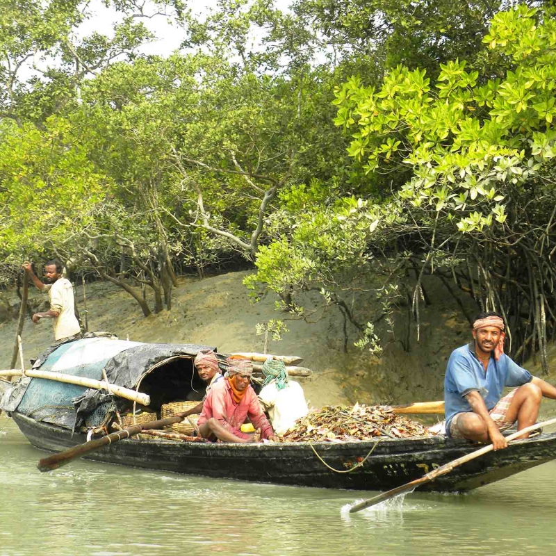
The people living in and around Sundarbans are mainly dependent on collection of non-timber forest produce (NTFP). Collection of wild honey in the wildness of Sundarbans is one of the main livelihood in this region and the people indulging in the same are locally called mouals. Other livelihood options in this area are collection of timber, fuelwood, and thatching materials, fishing and collection of gastropods. Shifting agriculture is also practiced in this area.
However, these professions pose risk of the highest order as the villagers are frequently attacked by tigers and other wild animals. Previously, masks were worn by the villagers on the rear side while entering the forest as tigers tend to attack from the back. However, with time this trick has ceased to bluff the tiger.
There is also a conflict between the officials responsible for protecting the forest and villagers who collect non-timber forest produce perpetually. By virtue of it being a biosphere reserve, there are stringent rules and regulations in Sundarbans that put restrictions on collection of NTFP. These restrictions are of various kinds, and apply on the number of issued permits as well as permitting entry only to the buffer area of the Sundarbans Tiger Reserve. However, in certain cases such as honey gathering, fishing and crab fishing, which typically involve animals, relaxations have been made in the rules. In general, collection of such forest products are dependent on specific areas—they are predominant in the eastern part of the biosphere reserve.
The collection of forest products is extremely dangerous. Villagers face threats from man-eating tigers and crocodiles. They don’t have any insurance policies, and claim for compensation is also a lengthy process. In case of incidents that happen inside the core area, they cannot claim compensation. The core zone is strictly banned for the collection of forest products. However, due to unsustainable harvesting and collection of the riverine species, their population in the buffer zone has gone down considerably, because of which the villagers have no option left but to enter the core zone. They take this risk to find resources for their survival and have often fallen victim to human-animal conflict.
Effect of climate change
The fourth assessment report of the Intergovernmental Panel on Climate Change (IPCC) observed that the tropical forest ecosystems are likely to be the worst hit due to climate change. As the Sundarbans lies in the tropical belt, increased temperature and precipitation, and increased salinity and extreme weather events like floods and cyclones, will have detrimental impact on its forests.
In 2007, IPCC notified that low-lying areas of the world would be prone to maximum calamities and disasters of climate risks due to sea-level rise and salt-water intrusion into underground aquifers, which would make cultivation difficult and contaminate sources of drinking water, something that Sundarbans is already falling prey to (Ghosh 2012).
In the Indian Sundarbans, sea surface temperature (SST) is increasing at 0.5 degree Celsius per decade. Globally, SST is rising at a rate of 0.06 degree Celsius per decade. Global warming will increase the pace of erosion in coastal and estuarine zones either through augmented summer flow from the glaciers or by increased tide penetration due to sea-level rise (Haq 2010).
The storms that occur before and after monsoon create more havoc than the ones which occur during monsoon. Such cyclonic storms usually happen three to four times a year in the Indian part of the Sundarbans. They cause heavy rainfall and flooding, followed by severe coastal erosion and collapse of embankments. Studies have shown that the frequency of storms, surges, depressions, and cyclones has gone down in the region. This is in line with the global climate models that forecast decline in cyclone frequency. Analysis based on the record of Indian Meteorological Department (IMD) shows that the frequency of storms in the Bay of Bengal has come down from 56 cyclones during 1921-1930 to 32 storms during 1951-1960. However, the gravity and strength of these events appear to be increasing, most likely as a result of rising SST. Sidr, Nargis, Bijli, and Aila are few examples of devastating cyclonic storms which has hit the region in the past few years. These cyclonic storms had detrimental effect, resulting in loss of lives and resources.
Recent research based on satellite imagery has shown that the sea level in Sundarbans is rising at an average rate of 3.14 mm a year (Haq 2010). The land got submerged at a rate of 8 sq km per year between 2000 to 2008, compared to 4 sq km per year between 1930 and the beginning of this century (Ghosh 2012). In the last two decades, four islands—Bedford, Kabasgadi, Lohachara, and Suparibhanga—got submerged, rendering 6,000 people homeless. According to scientists from University of Calcutta and Jadavpur University, Sagar islands, one of the largest island of this region, will lose at least 15 per cent of its habitat area by 2020 (Hazra et al 2002).
While on the one hand, the environmental problems of the region are escalating, on the other, according to the 2011 census survey, population of the area has crossed 45,00,000. This is nothing but a situation of limited resources for a massive population.
The first and foremost concern is the large-scale displacement due to loss of land. People have been forced to migrate to land located at a higher altitude. The increase in calamities of extreme nature in this region, mainly due to climate change, poses a threat to the safety and security of the inhabitants. Records show that in the last three decades, the number of people displaced from their original homes and/or islands in the Indian Sundarbans is approximately 7,000 (World’s First Climate Change Refugees 2009). This is due to a combined effect of sea-level rise, coastal erosion, cyclone incidences and coastal flooding—all of which are indicators of climate change. In monetary terms, property damage worth Rs 1,035 million has taken place in the last 20 years. Given that the region is vulnerable to coastal flooding, about 1.35 million people are presently at high risk and another 2.4 million at moderate risk.
In addition to the submergence of land, the area is facing constant erosion of embankments. Earthen embankments break frequently and they have to be fixed again and again. The task of building an embankment is tough as the pattern of water hitting the land from island to island and from shore to shore is different. For example, in the eastern parts, where the rivers have largely dried up, the seawater enters into the river channels more strongly than in the western sector, where the river flow is more. Tidal patterns vary as does tidal amplitude (height) which ranges from 2 to 5.5 metre from area to area. This variation leads to changes in the process in which erosion occurs in different places. Hence a generalised solution of building similar embankments doesn’t yield positive outcomes (Ghosh 2012).
People are affected not only by being displaced but also due to loss of resources in an area where natural resources are limited and scarce.
In the Sundarbans, the availability of free land has also decreased over time. Between 2001 and 2009, population density increased from 1,226 sq km to 1,666 sq km. This increase in density has been at the expense of available agricultural land that has decreased from 2,149 sq km in 2001 to 1,691 sq km in 2009. As agricultural land has been shifted for settlements, food production has also come down. This has resulted in decrease in income for people who were dependent on agriculture as their livelihood. The decrease in forest cover has also added to the poverty by affecting people who were dependent on subsistence economy.
Moreover, increase in saline content in the soil has added to the misery. There was a time when the embankments used to prevent seawater from flooding the land. But nowadays, as the embankments are collapsing, sea levels are rising, tidal surges are going up and cyclones are damaging the region, the level of salinity in some regions is over the safe limit for cultivating (for growing rice, the safe limit is 4-6 parts per thousand, or PPT). The northern part, which is much lower is salinity, has a salinity of up to 8 PPT, while the southern zone has 8 to 20 PPT. A saving factor can be good monsoon which helps by diluting the salinity of the soil. However, that possibility is negated due to irregular rainfall pattern in the region.
According to soil tests done by the European Commission of Humanitarian Aid (ECHO) after the cyclone Aila struck, salinity had reached a depth of about 1.5 metre in most areas. Paddy cultivation was reeling under its effect even two years after the cyclone. The study also revealed that sowing will now only be possible after the first spell of monsoon when the salinity gets diluted as an effect (Ghosh 2012).
The change in rainfall pattern has made it difficult for farmers to cultivate crops. It often extends beyond monsoon months, affecting agricultural productivity. There is often no rainfall when seeds are sown, but heavy downpour is experienced when the harvest is to be reaped (Danda 2010).
Besides agriculture, fishing is another important source of livelihood in this area. However, in the recent years, most fishermen complained that the volume of fishes caught has reduced. They attribute this to the increased level of salinity in the water that has caused migration and/or almost extinction of some fish species. Along with the fall in yields in agriculture, fisheries, too, have been dwindling throughout the Sundarbans (Ghosh 2012). The 1990 to 2000 study has shown a steady decline in the catch per unit effort of fish from 1984 to 2000. The same study finds that salinity pattern in Sundarbans depends on the flow of freshwater and tidal seawater in the estuary. The freshwater flow of the Ganges has been reduced, leading to increased salinity in the estuarine water and soil. According to the study, numerous reports have surfaced regarding drying up of fresh water rivers (Danda 2010). All these factors which have led to loss of livelihood have also shifted the source of income generation in many cases.
The shrimp collectors face problems of different sorts. They have to get a permit from the forest department. It’s not that they are unable to pay for the permit, but in most cases getting a permit is difficult as it requires travelling to another island where the forest range office is located. Only a little over half (55 per cent) the times when they venture into the forests, are they are caught by forest guards for not having a permit. On rare occasions, the boats are confiscated and members of the group are put behind bars which then becomes a costly and lengthy procedure. Thus, they consider going without a permit as a much easier option. This leads to collecting of shrimps much above the carrying capacity of the region and is unsustainable in the long run. This has resulted in scarcity of such shrimp already. Hence people who were initially dependent on such activities have to look for alternate sources (Danda 2007). In the mangrove forest the roots of trees provided a safe shelter to the fish, shrimp and aquatic reptiles. However, today due to effects of climate change most trees have disappeared (Treeless Forest 2000).
Other issues are cropping up as an effect of environmental threats, including climate change, resource constraint and human-animal conflict. The incessant struggle against environmental disasters and hazards in addition to the wretched condition of the villagers due to abject poverty and scarcity in these islands have put immense stress on their mental health. Psychiatrist Arabinda N. Chowdhury, who worked with the Institute of Psychiatry in Kolkata to understand the ill-effect of ecological conflict in the Sundarbans mangrove forest, found that there is a definite correlation between the two.
Empirical studies show that mental health clinics reported problems like major depressive disorder (14.6 per cent), somatoform pain disorder (14 per cent), post-traumatic stress disorder (related to animal attacks) and disorders related to adjustments. According to Prof. Barun Kanjilal of the Indian Institute of Health Management Research (IIHMR), in an area like Sundarbans mental health problem is an issue of grave concern. ‘People here are living under continuous stress due to various environmental challenges and frequent climatic shocks like storms or cyclones. It is because of a complex set of psycho-social stress creators which are closely linked to the gripping livelihood challenges in the region and may trigger a pandemic of mental health problems,’ he says.
In the villages located very close to the reserved forest, residents are extremely vulnerable to attacks from tigers, sharks and crocodiles as they mainly depend on fishing and collecting forest products. A study conducted on the clinical records of patients who attempted suicide in six government hospitals in the region shows that 65 per cent of patients were women. In the absence of proper mental health clinics, people resort to exorcists (ojha) to ward off ‘evil spirits’ in order to combats severe mental problems (Press Trust of India 2013).
Issues like continuous rise in population, reduction of livelihood opportunities and climate change have affected almost all the communities in the Sundarbans. In 2009, the area was devastated by Aila. A year later, income from farming which was estimated to be Rs 520 crore annually, reduced by 20 per cent. Besides this, fish production, which used to generate about Rs 100 crore every year, has also come down.
Lack of livelihood opportunities and dwindling resources have caused people to migrate from this mangrove delta. Rabindranath Bhattacharya, an economist who studied Sundarban’s economy for two decades, says, ‘Once the youth starts working elsewhere and earns good money, they become a node in the chain of agents who supply cheap labour to different parts of the country for a commission. Living conditions and disposable cash in many cases improve for them which act as inspirations for others to follow suit.’
In addition to men who have been migrating for few years now, women have also joined the league. Fringe jobs are not available anymore. These women thus, now depend only to be employed as domestic workers. The participation of women in Sundarbans in the Mahatma Gandhi National Rural Employment Guarantee Scheme (MGNREGS) is also relatively low as they are unable to do heavy jobs (hard manual labour) offered under the scheme. Scarcity of opportunities has given rise to social menaces like trafficking of villagers. The nature and process of trafficking done is different. These traffickers usually target the poor families and try to persuade them and even their daughters. These victims travel as far as cities like Mumbai and Pune and work as sex workers. Studies show that most of the girls who fall prey to traffickers are in the age group of 12-18 years. It was also found that when a family migrates from the Sundarbans, the children, mostly girls, often work as labourers or domestic workers (Ghosh 2012).
The problems this area deals with are manifold and layered. Extreme environmental conditions and its effects are a harsh reality. Empirical data along with scientific predictions show that the delta is extremely vulnerable. It is a fragile and unsustainable ecosystem which has the perpetual threat of being victim to ecological disasters.
Climate change is a macro-level effect and cannot be dealt with by any area or country. The problems that this area is facing can be dealt with proper planning, which is sustainable and localised, and effective implementation by the administration.
If the government fails to deal with this issue in time, ‘Sundarbans is destined to be the arena of the largest outward migration of humans in the history’ (Mukherjee 2013). This migration would be a result of overpopulation and climate-induced displacement. A study conducted by the School of Oceanographic Studies of Jadavpur University has predicted that about 70,000 inhabitants of the Sundarbans will become climate refugees by 2020 (Sahay Singh 2012).
References
Danda, Anamitra Anurag, Gayathri Sriskanthan, Asish Ghosh, Jayanta Bandyopadhyay, and Sugata Hazra. 2011. Indian Sundarbans Delta: A Vision. New Delhi: World Wide Fund for Nature-India.
Danda, Anamitra Anurag. 2007. Surviving in the Sundarbans: Threats and Responses—An Analytical description of life in an Indian Riparian commons. PhD diss., University of Twente.
———, ed. 2010. Sundarbans: Future Imperfect Climate Adaptation Report. New Delhi: World Wide Fund for Nature-India.
———. 2012. ‘Indian islanders seek jobs, husbands outside sinking Sundarbans’, Thomson Reuters Foundation, Mousuni Island, October 14. http://news.trust.org//item/?map=indian-islanders-seek-jobs-husbands-outside-sinking-sundarbans
Ghosh, Aditya. 2012. Living with changing climate: Impact, vulnerability and adaptation challenges in Indian Sundarbans. Edited by Jyotirmoy Chaudhuri. New Delhi: Centre for Science and Environment. http://cseindia.org/userfiles/Living%20with%20changing%20climate%20report%20low%20res.pdf (viewed on November 14, 2013).
Haq, Syed Azizul. 2010. ‘Impact of climate change on “Sundarbans”, the largest mangrove forest: Ways forward’, paper presented at 18th Commonwealth Forestry Conference, ‘Restoring the Commonwealth’s Forests: Tackling Climate Change’, Edinburgh International Conference Centre, Edinburgh, June 28 – July 2.
Hazra, S., Ghosh, T., DasGupta, R. and Sen, G., 2002. Sea level and associated changes in the Sundarbans. Science and Culture, 68(9/12), pp.309-321.
Mukherjee, Krishnendu. 2013. ‘Sunderbans is a sinking ship, warns Bittu Sahgal’, The Times of India, August 5.
Singh, Shiv Sahay. 2012. ‘One million people will need to relocate from Sunderbans by 2050’, The Hindu, May 24.
Press Trust of India. 2013. ‘How climate change worries have affected mental health of Sunderbans residents.’ http://www.firstpost.com/india/how-climate-change-worries-have-affected-mental-health-of-sunderbans-residents-1059233.html?utm_source=ref_article (viewed on May 29, 2017)
Treeless Forest. Down to Earth. 2000.
World Wide Fund for Nature. Worldwildlife.org. Southern Asia: Western Bangladesh into India. https://www.worldwildlife.org/ecoregions/im0162 (viewed on May 26, 2017).
World’s First Climate Change Refugees. The South Asian Life & Times. 2009.