
Introduction
Champaner (22º29’N 73º32’E), the flourishing capital of medieval Gujarat during the 15th–16th century, is located in the Halol Taluka of the Panchmahal district of Gujarat. It is situated about 45 kilometres to the north-east of Vadodara and 42 kilometres to the south-west of Godhra, the district headquarters of Panchmahal. The ruins of ancient Champaner are scattered over six square kilometres at the foot of the Pavagadh Hill which rises abruptly amidst the extensive plain to a height of about 800 metres.
The history of Panchmahal centres around Pavagadh-Champaner and hence attracted the attention of various scholars. J.W. Watson (1877) and Hermann Goetz (1949) were the first two scholars who explored this area and summarised their findings in works describing the Pavagadh Hill area and its monuments in terms of the evidence available at that time. The work of James Burgess (1971:39–44), though monumental, was limited to the description of the Jami, Kevda and Nagina mosques along with their subsidiary monuments. However, most of the features, except a few standing monuments spread outside of the present village of Champaner, remained buried and unnoticed till the last quarter of the 20th century. In view of its historic potential and uniqueness of structural features, the challenging task of reconstructing its glorious past was taken up by the Department of Archaeology and Ancient History of the Maharaja Sayajirao University of Baroda in the 1970s under the leadership of Prof. R.N. Mehta. Inspired by the graphic descriptions in Persian and Arabic literature, such as Ain-e-Akabari, Mirat-i-Sikandari, etc., and monumental structural remains spread throughout, the investigations were planned to reveal the settlement pattern and other details of the Champaner area. For the first time, archaeological methods were employed as a tool for the study of a medieval settlement as one of the three national projects, the other two being Fatehpur Sikri and Hampi, funded by the University Grants Commission. The present author was involved in the project right from the preliminary investigation, followed by explorations and excavations for a number of field seasons from 1969 to 1977.
Historical Background
Human beings have inhabited the area in and around Champaner since prehistoric times (Mehta 1977a). The Jorvan, a tributary stream of the Dhadhar, which originates from the Pavagadh Hill, revealed a variety of stone tools made basically of rhyolite, a local volcanic rock of which the Pavagadh is formed, which belongs to the Lower and Middle Palaeolithic periods. The tools of fine-grained material recovered from the valley of Bhadrakali, though by and large belonging to the Mesolithic period, sometimes show close affinity with the Upper Palaeolithic tools collected from Visadi and other sites in the vicinity of Champaner (Sonawane 1984). All these evidences clearly indicate human activity in and around Champaner during the first four phases of the Prehistoric period in a time range of approximately 200,000 to 3,000 years BP.
It seems this area might have remained uninhabited for a long time after the departure of microlith-using folk, till we come to the first century CE. The evidence of habitation in the Early Historic period is found in the form of highly disturbed brick structural remains belonging to the Kshatrapa period. Its historicity is also confirmed by the discovery of an upper portion (hopper) of a rotary quern having a horizontal bar in contrast to the customary vertical bar found in the rotary querns of later periods. Both the evidences are observed only in a small stretch of flat land in the Bhadrakali valley. Besides these, two silver-coated copper coins of Sarva Bhattaraka, one of the Maitraka rulers, have been reported from the same area. The Kapadvanj copper plates of Dhruvasena III, dated 653 CE, suggests Maitraka rule over Shivabhagapura Vishaya. Shivabhagapura has been identified with present-day Shivarajapur, a place situated about 12 kilometres southeast of Champaner. All these finds jointly suggest that there might have been sparse human habitation at the foothill of Pavagadh, particularly in the Bhadrakali valley, during the Kshatrapa as well as Maitraka periods. However, this area grew into prominence during the subsequent struggle for supremacy between the Gurjara Pratiharas and the Rashtrakutas. Later on, the Parmaras of Dhar and the Chaulukyas of Anhilwad Patan might have also made a claim to it. This is evident mostly in the form of Hindu as well as Jain temples constructed on the Mauliya Plateau of the Pavagadh Hill. Among the existing monuments of Pavagadh, the Pashupatinath Temple dedicated to Lakulisha, the founder of the Pashupata sect of Shaivism, is the oldest, dated to either late 10th or early 11th century (Sonawane 1980). On the same plateau there are three groups of Jain temples of the Digambar sect assigned to the 11th–12th century. Vastupal and Tejpal (1220–40), ministers of Chaulukyan King Virdhaval, are said to have built a Sarvatobhadra-type temple of Mahavirswami on the Pavagadh Hill. Thus, structural and literary evidence give fair indication of Pavagadh as one of the important Jain centres of Gujarat.
The first authentic account we have is of the Chauhan Rajputs, who fled from Mewad around 1300 and captured Pavagadh. An inscription found in a stepwell at Nahani Umarvan, about 6 kilometres to the south-east of Champaner, gives a complete genealogy of the rulers belonging to the Khichi branch of the Chauhans, describing them as descendents of Prithviraj Chauhan. It records names of 13 Chauhan chiefs, beginning with Ramadeva and ending with Jayasimhadeva. The fifth chief, Palhansiha, is said to have established the Chauhan power at Pavagadh. Out of these 13 chiefs, the historicity of the last three chiefs, namely Trimbak Bhupa, Gangarajeshvara and Jayasimhadeva, can be compared with other contemporary records. In those days Pavagadh held strategic importance because of its proximity to Malwa. Most of the rulers of Gujarat who aspired to conquer Malwa wanted to possess Pavagadh. As a result, most of the Gujarat Sultans attempted to annex Pavagadh to their kingdom. During the time of King Trimbak Bhupa, Sultan Ahmad Shah I of Ahmedabad tried to capture Pavagadh in 1418. It seems King Trimbak Bhupa surrendered to the Sultan by paying a tribute, and was thus allowed to retain his sway over Pavagadh. Another important incident took place during the time of king Gangarajeshvara, the son and successor of Trimbak Bhupa. Sultan Gyasuddin Muhammad Shah, the son of Ahmad Shah I, attacked Pavagadh in 1449. King Gangarajeshvara fought bravely but when defeated shut himself in the fort of Pavagadh and appealed to the Sultan of Malwa, Mahamud Khilji, to help him in this predicament. The Sultan of Malwa came to his rescue with a large force and prepared to attack the forces of the Sultan of Gujarat, which compelled Muhammad Shah to give up the siege and retreat to Ahmedabad. The same event with some modification in favour of Gangadasa is narrated in the contemporary historical Sanskrit play titled Gangadasa Pratapa Vilasa Nataka, composed by Gangadhara, a court poet of Gangadasa (Sandesara 1973). This drama was performed at Pavagadh in the sabhamandapa of the shrine of the Goddess Mahakali, the presiding deity of the fort, to commemorate the event. There is a detailed description of the fort of Pavagadh in Act VII of the play. One fragmentary stone inscription was also found from the Champaner village by the author. This inscription also refers to the king Gangeshwara (Gangarajeshvara or Gangdasa) and Pavakadurga (Pavagadh). As it is fragmentary, exact details of it are not known, otherwise it could have provided very useful information about Gangarajeshvara and his rule (Sonawane 1979:435–36).
The Chauhan hold over Pavagadh came to an end when Sultan Mahamud Shah I, popularly known as Mahmud Begada, captured it after a 20-month siege on November 21, 1484, by defeating Jayasimhadeva, the last Hindu ruler of Pavagadh. This was the turning point in the history of Champaner. Sultan Mahmud Begda, like his grandfather and father, aspired to capture Pavagadh because of its strategic importance. He might have felt that the possession of Pavagadh was quite essential to become the sovereign king of Gujarat and to lead successful military operations against Malwa. This is the reason, probably, why he shifted his capital from Ahmedabad to Champaner, and renamed it as Mahamadavada. An inscription in nagari script dated to Vikram Samvat 1554 (1498 CE) found in a stepwell at Mandvi, one of the suburbs of Champaner, clearly mentions the name of this newly established capital (Sonawane 1972). In order to create a new capital, it appears, intensive efforts and planning might have been executed for about half a century from 1484; it was aimed to convert it into a large prosperous city with well-laid out fortifications, roads, bridges, gardens, aquatic constructions besides civil, military and religious structural components befitting an ideal capital. However, the glory of Champaner did not last long. In 1553 it was plundered by Humayun, the mighty Mughal emperor of the Delhi Sultanate. As a consequence, the once glorious city described as Shahr Mukarram ('Illustrious City') witnessed rapid decline as the capital was transferred back to Ahmedabad after the death of Bahadur Shah in 1553. Somehow it survived up to the 17th Century as the district headquarters under the Gujarat Sultans before it was occupied by the Maratha rulers of Gwalior, the Scindias, and then by the British (Sonawane 2004).
Preliminary Reconnaissance
A reconnaissance study carried out by the Department of Archaeology and Ancient History of the M.S. University of Baroda initially helped immensely in understanding the nature of the settlement pattern of the site, particularly at the foothill of Pavagadh, focusing more on the urban capital structures of medieval Champaner (Mehta 1981). The survey carried out at the site revealed the ruins of a circular townscape scattered over six square kilometres within a radius of about two kilometres. It was also observed that the Hissar-i-Khas or Royal Citadel (also known as Jahanpanah, meaning ‘world shelter’) located at the nodal point and other residential and public buildings of the common masses were enclosed within the first outer horseshoe-shaped defence wall with nine gates. This defence wall covers an open space against the natural protection of Pavagadh, between the north-eastern end of the Saria Vakaria hillock and south-eastern flank of Pavagadh extending up to the Atak Fort. Besides the main city, suburban settlement areas were also noticed on the eastern and western sides, outside the fortified area, extending upto the Vada Talav and the town of Halol respectively. It appears, the city was planned to perform the dual role of a state capital and a strong defence frontier. A fair analysis of the archaeological data revealed that the city was divided into several sectors, well-connected with radiating roads leading towards the royal enclosure.
The gates on the outer periphery wall proved useful for identifying main roads, which usually ran in a straight line in the form of broad shallow depressions. On either side of these roads structural debris of residential buildings were also observed. Subsidiary arteries dividing the settlement into several blocks were found to be interconnected with most of these roads. On some of the road crossings, shop-like structures were identified and interpreted as markets for local areas. Also found at the junction of such roads were well-preserved mosques—Jami, Nagina, Kevda, Iteri, Lila Gumbaja, Babaman, Kamani, etc.—considered fascinating masterpieces of Muslim architecture. Similarly, several mausoleums/tombs (makabaras), either found in the mosque complex or in separate independent areas, stand as marvellous specimens of medieval architecture. Of these, the tomb near Nagina Mosque, Baradari near the Kevda Mosque and tomb of Sikandar Khan and Shakar Khan are worth noting. Equally amazing is the water harvesting network found throughout the settlement in the form of lakes, ponds, ring wells, stepwells, wells, tanks, cisterns, etc. The most unique among these being the Helical Vav (stepwell), the Geban Shah Vav, the Chandrakala and Suryakala Vav, the Sat Kuva Nav Vavdi at Kanjri and the octagonal tank of Jami Masjid—all superb examples of aquatic constructions. Gardens and resorts, particularly those found within the royal enclosure and one on the bank of Vada Talav near Khajuri Masjid, reflect the fine tastes of the occupants and planners. The remains of sarais, a Christian prayer hall (Mehta 1977b), bridges, markets, kabarasthans, etc., point towards the existence of basic civic amenities. From the structural remains of residential buildings, considering their location, area occupied, nature of construction, material used and antiquities found therein, it appears that the settlement was divided into different segments of society based on their political, social and economic status.
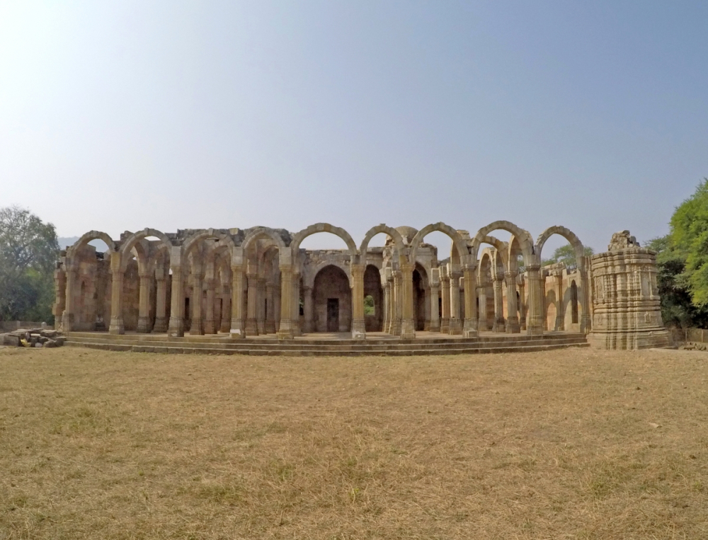
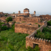
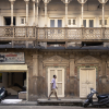
Fig. 1: Remains of Kamani Masjid
Excavations
While a preliminary study carried out at Champaner revealed a broad outline of the town plan of this important medieval city and provided insight into the socio-political scenario, extensive excavation studies were planned in order to gather further details of the life patterns in society, after identifying buildings representing residences of noble and lower middle class communities, besides shopping centres.
An area lying between a small stream which runs parallel to the Saria Vakaria hillock and Road No. 1, named as Sector A, revealed a large residential complex, probably occupied by the nobles or amirs. Out of these, one unit measuring 208 x 144 metres, with the longer axis running east–west covering the entire width of Sector A, was taken up for horizontal excavation, in order to expose the complete layout with all possible details in archaeological perspectives. The excavation brought to light an interesting structure with the main opening on the eastern side facing Road No. 1. This main structure is located about 128 metres away on the west of the main entrance, leaving quite an open space between the two points. The outer compound wall, running north-south, revealed eight shops opening towards the main road. The main entrance with intact doorjambs is guarded by guardrooms, one on either side, besides that of a small circular watchtower. Being a vast complex, it consists of several components associated with the main building such as a residential area, guest house, waiting rooms, servant quarters, apart from gardens with resorts, wells, water channels, drains, stables, etc.
The main two-storeyed building, measuring 17.60 x 9.75 metres and constructed on a raised plinth, is composed of a central pillared hall with rooms attached to its southern, western and northern sides. Big niches with nine compartments, probably used as cupboards or wardrobes, featuring intricate floral mural paintings in red against the white background of fine lime plaster were also found. The entire complex revealed traces of monochrome mural paintings depicting royal symbols such as the chhatra (umbrella) and chamar (flywhisk), a variety of stylised plantain trees with parrots and others birds among the foliage, water pots and surahis besides simple linear borders. The rooms, on either side of the central hall facing east, also have balconies overlooking the open courtyard. Another room located in the southwestern corner has an underground cellar. The roof as well as the floor is made of thick compact lime concrete. Loose stone pillar bases (kumbhis) found while clearing debris along with regular insitu pillar bases of the central hall suggested the construction of another storey above the ground floor. The absence of a kitchen and household objects in any of these rooms suggest that its main owner might have used it basically to transact his business. An open courtyard found in front of the main building provided paved entrance through a passage, with attached rooms on either side. The structures exposed on the southern side next to the main building, leaving a long open passage, and those on the western periphery beyond the garden behind the main structure represent well-suited residential quarters.
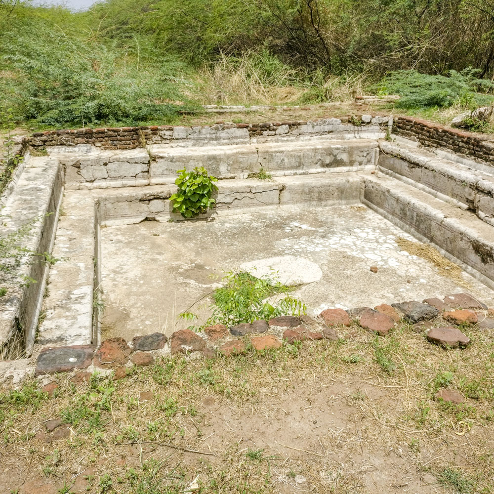
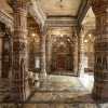
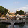
Fig. 2: Indoor water structure in Amir Manzil
However, what is worth noting is the provision of pleasure gardens and tanks well-connected with feeding channels of fresh water drawn from a specially designed large well located at the highest point within this complex. One of the gardens located on the northern side just in front of the side entrance through the main courtyard has 10 built-in circular flowering plant basins connected with water channels. Another garden located further east has six similar circular plant basins. While both the gardens can be approached through a separate entrance provided from the outside, only the first garden is also accessible through the main entrance. A third garden situated behind the main building and the adjoining rectangular tank deserves special mention. It is laid out on a unique plan. Within this garden, just behind the rectangular tank, are located small octagonal tanks with sloping sides. To descend into the tank, sets of three small steps are provided from the western and eastern slopes. Pillar bases with sockets are provided on the four corners encircling the tank in order to erect temporary screen walls, probably in the form of a curtain. The tank is flanked by spiralled water channels on the southern and northern side. The main water channel which comes from the southern side is attached with the southern spiral as an inlet in order to provide a constant supply of running water to the octagonal tub. Similar to the manner in which the water accumulates in the octagonal tub through the southern spiral, it goes out through the northern one. Its location, design and special care taken for erecting screen curtain around the tub suggests that it was meant for only female members as an hammam (bath). There is a bigger rectangular tank located between the two gardens along the northern side of the main building sparing space for the water channel and human movement. It has landing steps on the eastern and western sides all along the shorter axis. The compact lime floor of the tank revealed faint traces of painted patterns, drawn in red, featuring an intricate combination of geometrical and floral motifs. On the tank floor, besides a square pit to accumulate dirt during periodic cleaning, a small aperture to drain out water also exists. This might have been used as a bathing pool for men, may be with restricted entry. Another octagonal tank of bigger dimensions with steps from the cardinal sides was found in the southwestern corner of this residential area.
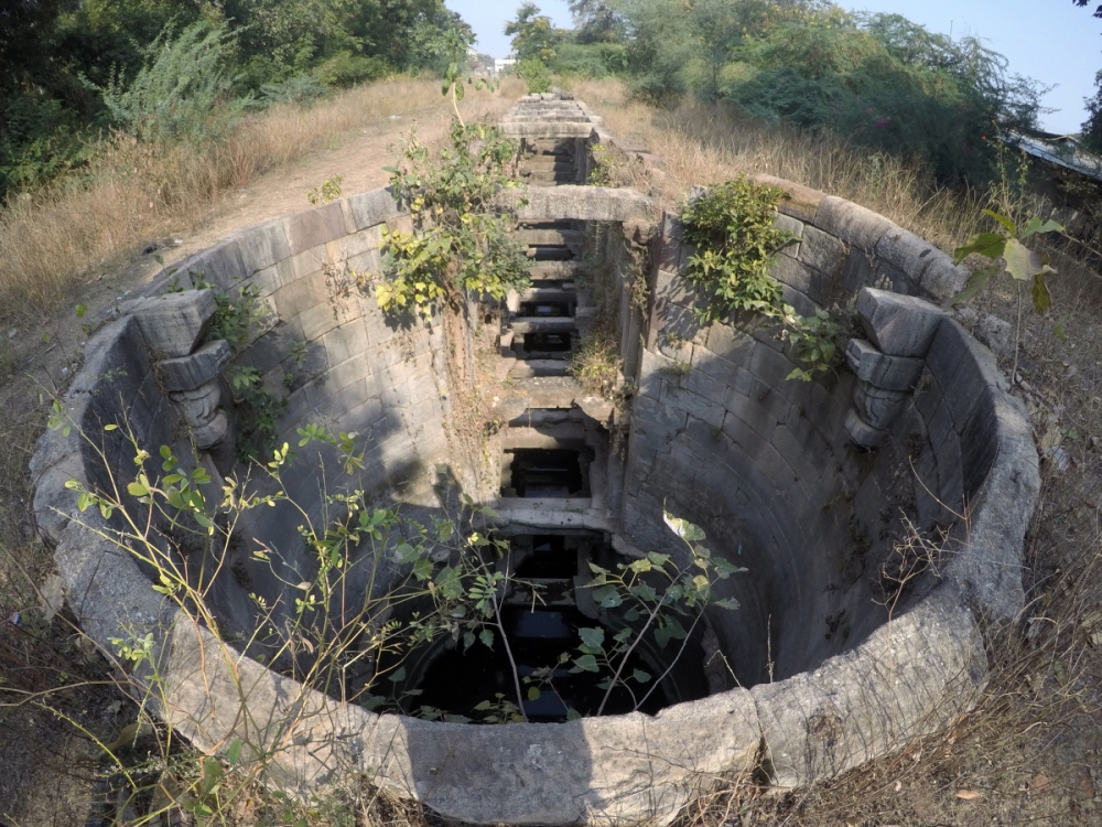
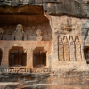
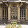
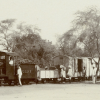
Fig. 3: Geban Shah's Stepwell
An equally important unit of the same complex was located to the south-east of the main area occupying the middle portion of the southern side. It consists of residential and garden areas covering the eastern and western halves respectively; probably occupied by other family members. At least four families must have been living here independently in separate blocks but well-connected with each other. Each independent block with little variation in plan and space suggests a basic layout comprising open courtyards, corridors, central halls with attached rooms retaining symmetry, besides the provision of storage for goods, water, kitchens, baths and even toilets. The western half, which was reserved for gardens, revealed several identical circular built-in plant basins connected with two water channels running parallel south–north from the main well. The offshoots of these main channels run east–west on either side covering the entire garden area to facilitate sufficient water supply for the maintenance of well-developed gardens. Two more water tanks, one in the garden area and the other close to common latrines in the residential area have steps in diminishing order along the four sides. The prime source of water, i.e., the well, is also located in this area, from where the entire complex was watered through its fascinating water distribution system. Though most of the freshwater channels are kept open, at places they are covered, mostly for ease of movement, and are sometimes even underground, below some of the house floors, opening directly either into the tanks or gardens. However, the most sophisticated system of aqueduct is employed at the main entrance of the main building, through one of the freshwater channels. Over and above, it may be said that adequate sanitary measures were also taken by providing rainwater drains and waste water drains to discharge polluted water as well as sewage, of these the latter ones being carefully covered with bricks of the required size.
Another noteworthy structure identified as a horse stable is located to the east of the second residential annexe, within the open ground, along the southern compound wall. This rectangular, partly covered structure, measuring 35 x 10 metres, revealed in the middle 28 sandstone rectangular, one-meter high pillars with round top and grooves below for tying horses. These pillars were erected in a series of 14 in a double row, leaving 2.20 metre distance between the two rows. While clearing the debris of the stable, horse-droppings were recovered, leaving no doubt of its functional utility. Judging from its location, large size, layout of the residential buildings, quality of material used, provision of gardens, tanks, personal well, water channels, possession of a fairly big stable, grand main gate, adequate open-air space with platforms and a variety of classical antiquities, it may be conjectured that the residential complex was occupied by one of the high-ranking officials or noblemen of Sultan Mahmud Begada.
Another complex selected for excavation, identified as a lower middle class settlement, lies between the main street running east–west connecting the Kevda and Iteri mosques, a part of sector K1. All nine blocks are located on the southern flank of the road where a westerly lane joins the former, covering an area of about 70 x 40 metres. Excavation in this area revealed relatively simpler structures, varying from single to multi-roomed blocks made of rubble set in mud mortar, arranged in a double row, blocking the eastern side thus leaving a wide space in between. The inner wide space can be accessed from the side lane. Again, Block no. I was separated from rest of the blocks by the by-lane, which joins to the main street from the inner open area. Most of the house floors are made of compact rammed earth except a small corner of Block no. IV, where two storage jars were found buried underneath a lime-plastered floor. Though the main entrance of individual blocks have doorjambs, internal doors are without any such doorframes.
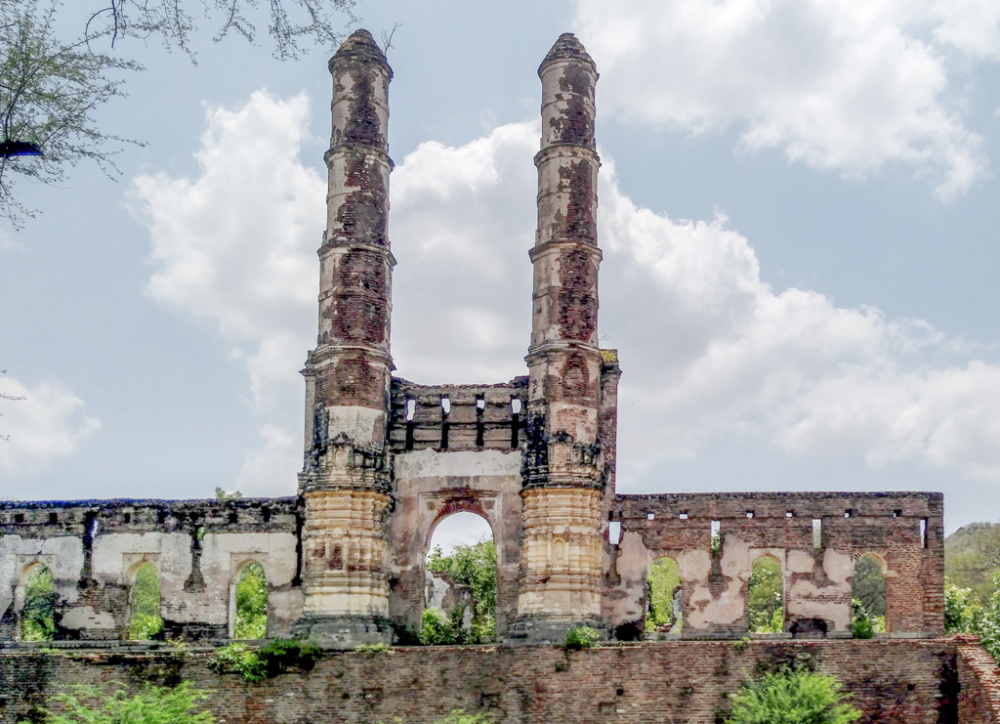
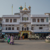
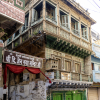
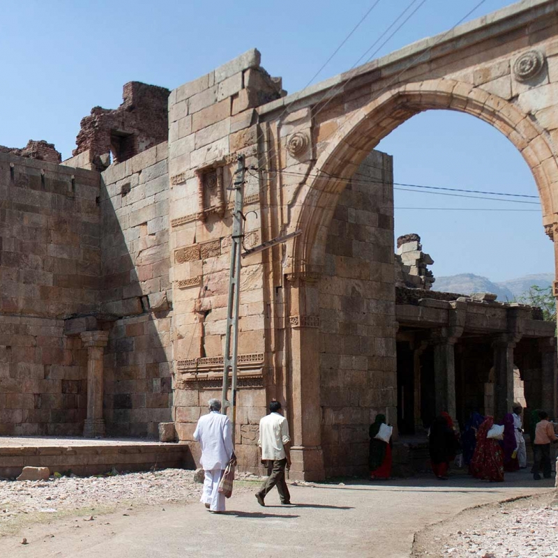
Fig. 4: Iteri Masjid
Further on, equally interesting remains of a shopping complex was brought to light by excavation carried out at the south-western corner of the junction where Road no. 1 joins the east–west road connecting the Kevda and Iteri mosques. This rectangular area forming a part of the sector C, measuring 45 x 15 metres, is separated by an arm of Road no. 2 which joins Road no. 1 about 15 metres further north from the junction. A series of shops facing the road on the southern and western sides are laid on a raised common plinth, with rounded corners providing an offset on either side. It may be observed that good-quality, well-dressed sandstone blocks were used for the construction of the plinth. Sufficient space is provided on the plinth in front of the entrance of each shop, probably to facilitate movement from one shop to another. Interestingly, a sort of ramp is provided from the southern side to reach the shops. The excavation of the area revealed 11 such shops. From the structural features and antiquities recovered, it appears that the front part of the structure was used as shop, and the back portion as store-cum-residence with a partition wall in between. All these shops-cum-residential units have a common backyard connected with an arm of Road no. 2 on the northern side. Provision for storage in the form of big storage jars, some buried underneath the store floor, revealed variety of iron objects such as knives, scissors, razors, clamps, a variety of nails, rings, sockets, etc., obviously for sale. Household objects, mostly in the form of pots and pans, and kitchen equipments of stone were found littered in the inner compartments. Raised platforms meant for keeping water pots known as paniyaras were also identified in some of these shops. The floors as well as sidewalls were found to be plastered with lime. One trial dig conducted outside the western wing of the shops on Road no. 1 suggests that it was paved with rubble. Two raised platforms found along the roadside near the junction might have been used by pedestrians to rest, although they were earlier identified as graves.
Antiquarian Remains
A wide range of antiquities recovered during the exploration followed by excavation of selected areas throw much light on the lifestyle of the people who populated Champaner in its prime. Though a major bulk of the assemblage consists of different types of ceramics, both local as well as imported, other antiquities including a variety of stone, terracotta, iron, copper, silver, glass, bone, shell and ivory objects speak of the wide range of materials used by the people of medieval Champaner to sustain their various needs. Among ceramics, plain and burnished varieties of red as well as black ware were quite predominant, representing bowls, dishes, basins, pots, jars, lids, spouted vessels, strainers, etc. Of these, small pots of fine red ware made of lavigated clay and decorated either with incised or stamped designs, probably used on special occasions as luxury items, are worth noting. Painted decorations, however, were rarely observed. Similarly, glazed ceramics also seems to be quite popular. Normally blue and green or a combination of blue and white were the colours used for glazing the vessels such as dishes, bowls, small globular pots and jars with handles. Quite often green-glazed half-round roof tiles were also reported from the residential areas of noble and like communities. Besides these, the presence of Chinese celadon and porcelain, because of their superior quality, though found less in quantity, speak of the tastes of the people. The Chinese celadon, because of its quality of revealing poison in the food, was supposedly used as tableware by the Sultans and Muslim nobles. On the other hand, porcelain vessels with thin fabric, milky white in colour, were profusely decorated with painted designs, mostly in blue. Depiction of Chinese dragon, though not common, finds a place in some of the dishes of china clay. It is generally known as the 'Ming Blue and White' because of its production during the rule of the Ming dynasty in China (1368–1644). Interestingly, apart from the Chinese letters, letters in nagari script were also found on some of the sherds, probably indicating tactics followed by the Chinese manufacturers to capture Indian markets.
Besides quite a large number of household or kitchen stone implements such as rotary and saddle querns, pestles, mortars and mullers, ornamental beads of carnelian, pendants, finger rings add to the tastes developed by the people to adorn themselves. Terracotta objects mostly in the form of toys representing horse, camel, bull, elephant with howdah, tiger, etc., were reported in large numbers. As usual, hubbed wheels and perforated discs were aplenty. Moreover, iron objects including nails, knives, scissors, clamps, sickles, pickaxe, rings, chains, arrowheads, spearheads, swords, chain armours, horse bits, horseshoes and caltrops associated with domestic and military activities further substantiate our understanding on the use of this metal. Of these, the discovery of caltrop is of great significance, suggesting its use during warfare, particularly to prevent advancing enemy elephants in battlefield. It seems some of these objects might have been locally manufactured in a nearby village called Katodia, which has revealed evidence of iron smelting. Apart from iron objects, objects of copper, though not many, found in the form of toe rings, finger rings, bangles, boxes with lids, hooks, nails, earrings, bells, twisted drills, etc., form an important assemblage. Some of them were recovered from one of the shops found in front of the excavated Amir Manzil, suggesting it was a copper merchant’s shop. The presence of flat circular bottle-like pitchers of copper, perhaps meant to preserve sacred water called Abe Zamzam from Mecca, as Hindus keep gangajala in such specially made bottles, confirm some of the religious practices. Discovery of copper coins of Gujarat Sultans establish the period of settlement with authenticity. A solitary intaglio signet ring of silver, found during excavation of Amir Manzil, inscribed with the name of Abdul Bak Safavi alias Baba Gulam Ali helped to identify the owner of this large residential complex. Shell objects such as beads, rings and bangles were few and far between. Among other objects, monochrome and bichrome varieties of glass bangles, beads, bottles of perfume and bowls mark their presence. However, socketed handles of ivory, plain and decorated, come under the category of rare commodities (Mehta 2002).
Conclusion
The work carried out, thus, not only revealed the nature of the settlement during the 15th–16th century but also brought to light remains of the prehistoric period and gave fair insight into the early history of Champaner. Subsequently, the scenario changed as the socio-political factor became more important for its growth, with the Pavagadh Hill as its backdrop. The Gujarat Sultans wanted a strong frontline defence against the Sultans of Mandu, which led to the growth of Champaner. Thus the political decision to develop it as a capital became the main factor for its phenomenal growth and prosperity. The nodal planning of this radiating city was well-executed with the royal enclosure situated at the centre against the safeguard of natural defence provided by the Pavagadh Hill, and the location of several mosques at crucial points. So is the case with the residential complexes of the retinue of amirs and shopping centres. The other inhabitants occupied remaining zones, identified for different social orders, where groups of occupants lived together in areas similar to the traditional Indian settlements in the form of pols, vada, katara, etc. Unfortunately, the absence of toponyms hinders the clear understanding of these relics in their linguistic phenomenon, but their physical features are quite distinct. However, the presence of a sizeable Hindu population is discernible in the Bhadrakali valley, as suggested by excavation findings in that area. Possibility of such localities in other areas cannot also be ruled out. An inscription dated to Vikram Samvat 1554 (1498 CE) found in a stepwell in one of the suburbs of Champaner begins with an invocation to Ganesha and Sharada and gives astronomical data of the year, time, day and other details of the Hindu calendar, in a mix of Sanskrit and medieval Gujarati written in Devanagari script, pointing to religious harmony.
The absence of valuable items in the excavated material recovered from the Amir Manzil, such as gold, silver, ivory, precious gems, etc., suggests that such prized articles must have been carried away safely by the people while leaving the settlement. The collapse of this flourishing capital city in the 16th century, especially after 1535, and subsequent abandonment of the area, though sudden, was peaceful as a result of the decision to shift the capital. This event did not witness any political turmoil and hence that is not reflected in the archaeological data. In this context, again, unfortunately, it is not possible to have even an glimpse of the palace and other associated structures of Sultan Mahmud Begada located within the royal enclosure as it was razed to the ground by Emperor Humayun while plundering the city.
Thus, excavation carried out in the area, where a full-fledged settlement developed over a period of half a century with strong defence management, magnificent monumental buildings, roads and bridges, gardens and pleasure resorts, excellent system of water management and provision of civic amenities, gave us a fair idea about the sophisticated urban ethos of the medieval period. No wonder, though late, the state of Gujarat got its first World Heritage Site tag when Champaner-Pavagadh was recognised by UNESCO at the 28th session held at Suzhou, China, in June–July 2004, for its heritage status par excellence.
References
Burgess, James. 1971. On the Muhammadan Architecture of Bharoch, Cambay, Dholka, Champanir, and Mahmudabad in Gujarat. Delhi: Indological Book House.
Goetz, H. 1949. ‘Pawagadh-Champaner’. Journal of the Gujarat Research Society 11.2:1–67.
Mehta, R.N. 1977a. Prehistoric Champaner: A Report on the Explorations of prehistoric Sites Around Pavagadh Hill. Vadodara: Department of Archaeology and Ancient History, Faculty of Arts, M.S. University of Baroda.
———. 1977b. ‘A Christian Prayer-Hall of Champaner’. Indica 14.2:111–16.
———. 1981. ‘Champaner: An Experiment in Medieval Archaeology’. In Madhu: Recent Researches in Indian Archaeology and Art History, edited by M.S. Nagaraja Rao, 119–28. Delhi: Agam Kala Prakashan.
———. 2002. Champaner: A Mediaeval Capital (Second Edition). Baroda: Heritage Trust and Archaeological Survey of India.
Sandesara, B.J. ed. 1973. Gangadasa Pratapavilasa Nataka: A Historical Sanskrit Play by Gangadhara. Baroda: Oriental Institute of Baroda.
Sonawane, V.H. 1972. ‘Mandavi step-well Inscription at Champaner, Samvat-1554, Shaka-1419’. Journal of the Oriental Institute of Baroda 21.3:224–27.
———. 1979. ‘Archaeology of the Panchmahals’. Unpublished Ph.D. Thesis, Faculty of Arts, M.S. University of Baroda.
———. 1980. ‘Pashupatinatha Temple at Pavagadh’. Journal of the M.S. University of Baroda 29.1:40–46.
———. 1984. ‘Prehistoric Cultures of the Panchmahals’. Man and Environment 8:20–30
———. 2004. ‘Pavagadh-Champaner: A Historical Sketch’. Paper presented at the seminar ‘Heritage Tourism: Exploring the Future’, Ahmedabad.
Watson, J.W. 1877. ‘Historical Sketch of the Hill Fortress of Pawagadh in Gujarat’. The Indian Antiquary 6:1–9.