
And all along flows the Jhelum, the Hydaspes, the Vyeth, the Vitasta. Through its many names never missing a spire, not a shrine or temple ghat. It touches everything, and blesses everything. It connects everything—in space, in history, and in spirit.[1]
The day after I landed in Srinagar on May 22, the Valley was shut down following the encounter killing of Zakir Musa, one of the senior-most Hizbul Mujahideen commanders in Kashmir. Following mass protests in Srinagar, access to Downtown (Old Srinagar) had been declared unsafe. My first objective was to seek clearance from the administration to access the Kaman Aman Setu (exit point of the Jhelum River from India) on the Line-of-Control, close to Uri, as part of my research for the Sahapedia Frames Photography Grant. Access to the heavily militarised L-O-C is restricted for civilians, and one needs prior permission. Since all roads going to Downtown remained barricaded even a week after I had arrived, I resolved to take a shikara down the Jhelum and shoot from the river itself.
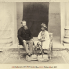
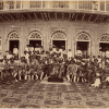
In May, the water of the Jhelum was on Flood Alert level, and persuading haanjis (boatmen) to take me down the river felt reckless and selfish. While negotiating with the haanjis at Rajbagh, I realised that in the absence of patrons, the tradition of leisurely boat rides through Downtown had largely been forgotten. Only a handful of haanjis now operate on the Jhelum River. Younger generations seek more stable sources of income. Noor Mohammad Pakhdoomi, one of the older haanjis, tried to dissuade me with myriad reasons—the water is too deep, the current too strong, the route too long, too strenuous to be a one-man job, lives or boats too precious to be risked. Yet, perhaps swayed by nostalgia of an old tradition, or simply the love haanjis have for water, he agreed in the end. My local guide had come to see me off on my river tour. ‘I will shoot a video of you departing in this boat to send to your mother after you drown,’ he told me. ‘Rest assured that if the boat sinks, the haanjis will only save themselves,’ he warned me as he waved our party off.
My buoyant spirits at the onset were quickly replaced by terror. The deceptively placid Jhelum at Rajbagh changed dramatically as it crossed Lal Chowk and entered Downtown. The Jhelum here cuts through the supporting posts of the bridges, breaking into narrower streams. The water rose up to form rapids and a current so swift, the boat swerved violently. Our small shikara crashed ashore, where alarmed feral dogs charged at us. Fending them off with oars, one of the boatmen drove a pole onto the riverbed and pushed away from the bank. They laughed all the while, and reassured me of my safety.
They say that shared experiences bring people closer. The three people on the boat—me, my haanji and his helper—began to relax and talk. My questions were rewarded with utmost attentiveness and detailed responses. The haanjis knew the waterways like the back of their hands, and they pointed out and explained to me many features of the Jhelum that I had never registered before—navigability, the course of the river and its tributaries, the varying widths, depths, and reasons for change in colour of the water, and how they were eternally vigilant for signs of flooding.
--------------------------------------------------
The Jhelum forms the spine of Srinagar city. Kashmir’s capital developed along both banks, stretching approximately 10 kilometers from the river. The primary transport route is supported by secondary waterways and flood spill channels that connect the river with the Dal and Nigeen Lakes. Its riverfront has two distinctive segments, each with its starkly different urban character.
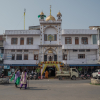
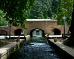
The colonial riverfront, locally called the Bund, begins in the south-east at Sonwar and continues downstream till the first of the seven bridges across the river at Amira Kadal. Today, the Bund is fractured into three distinct segments. The first section, Sonwar Bagh to Zero Bridge, is heavily militarised, hence has little pedestrian traffic. The second stretch, from Zero Bridge to the Post Office, is lined with graffiti-filled high walls and barbed fences, which make for an oppressive, claustrophobic walk. The third stretch, extending from the Post Office to the SPS Museum footbridge, is lined by craft emporiums, restaurants, tea rooms, shops, mosques and riverfront parks. This is the only vibrant part of the Bund that bears some semblance to its old colonial atmosphere.
In comparison, the Downtown riverfront is a few hundred years older and starts at the first of the seven bridges at Amira Kadal, and continues till Chattabal, a little further north-west from the seventh and final bridge of Safa Kadal. Downtown’s old name was Sheher-e-Khaas, and the riverfront buildings here reflect the sophisticated taste of the wealthiest and most influential in the city of the past. Here, the buildings are built directly on the edge of the river, in the traditional taq (timber-laced masonry) and dhajji-dewari (timber frame with masonry infill) techniques. Their incredibly detailed projecting dab windows appear to hang over the water of the Jhelum.
The running facades on the Jhelum are punctuated by narrow ghats known as yarbals (literally ‘places of friendship’). These open community spaces once used to be crowded in daytime by residents of the neighborhood. The only humans who now visit the yarbals are a handful of carpet manufacturers, washermen, and the occasional fishing enthusiast. The entry to these homes are from the river, however, today the city and their houses have literally turned their backs to the Jhelum. The newer buildings are designed to face away from the river, and sewage is emptied into the waters directly from the river-facing toilets and baths. In the old city, a majority of drains open directly into the river. People dropping bags of trash from the bridges and throwing solid waste from their windows straight into the Jhelum is a common sight. The only life form visible are packs of feral dogs that scavenge its banks, and swarms of black kites that circle above. In the smaller channels, however, people still gather to chat by the river, women wash clothes, men fish, children play, and separatist political graffiti becomes too rampant to ignore. Otherwise, the river that once shared every lived experience of the city, has shrunk from collective memory. As Wasim Bhat points in his essay ‘Captive City’, ‘Srinagar is a city that still lives on water, though no longer with it.’[2]
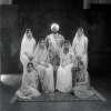
Apart from the haanjis, the Gujjars and Bakharwals[3] are the only communities who have preserved the collective memory and traditional knowledge about the Jhelum. While travelling up and down the course of the Jhelum, I met several Gujjar and Bakkarwal families who camp on its banks. Familiar with the mountain ecosystem through their yearly migrations, the Gujjars and Bakkarwals narrated to me tales alive with ancient wisdom passed down through generations, and the repercussions that humanity has had to face when the sanctity of water was not respected.
Through my earlier research, I was already familiar with the mythological story of how Kashmir was once under the Satisar lake (lake of Sati) which was drained by the sage Kashyap. The newly revealed Kashmir Valley suffered from a shortage of water. Lord Shiva, moved by the prayers of devotees, requested his consort, the Goddess Parvati, to take the form of a river and descend on the Valley. Parvati asked Shiva to show her the location from where she should emerge, and he marked the spot with a strike of his Trishul (trident) at Verinag. In the narrative of the herders and boatmen, each time Parvati emerged as a river, she was met with such cruelty at the hands of humans that she vanished. Through the ages, she repeatedly disappeared seven times, but was reborn every time through the prayers and persuasion of gods and devotees.
The Gujjars and Bakharwals cited a total of eight glaciers and alpine lakes whose waters combine to form the spring at Verinag. I was only told of the two holiest sources—Ramnavami and Sarbal—that can be reached by long and arduous climbs, pilgrimages that must be observed with several rites of passage, which if violated, leave the disrespectful buried under avalanches. But the six other sources appear to be jealously guarded and not recommended as casual treks to the irreverent traveller. I visited a spring further upstream from Verinag by the name of Vyathvutur (Vyathvutur is the ancient name of the Jhelum), locally known as Vyath. The sanctity of the springs is maintained with equal sincerity by Muslims and Hindus, who disturb the waters only to drink, or perform ritual ablutions. In their deference, they seem to be the only ones who remember that the Jhelum carries with it thousands of years of history, culture and belief systems.
--------------------------------------------------
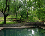
After a week of curfew, restrictions on travel outside Srinagar was lifted, and I headed towards Wular Lake, Sopore and Baramulla. Outside Srinagar, both upstream and down, the Jhelum is pristine, spanned by dilapidated bridges, overlooked by hill-top temple ruins, and lined by melancholy Mughal gardens. Three routes overlap along the Jhelum—the Vitasta Kund Route followed by Hindu pilgrims to visit the many temples erected along the river over centuries, the Pakhli Route that the Mughals took to enter Kashmir, and the Jhelum Valley Cart Road that was constructed to bring the first vehicular traffic from British Punjab during the Dogra period. These routes have been traversed for centuries by pilgrims, pillagers and pack animals. Golden filigreed umbrellas shimmering atop the green multi-tiered pyramidal roofs of astaans (shrines), white gurudwaras marking the places visited by Sikh gurus, and cemeteries full of graves of preachers, poets, poetesses, and revolutionaries nestled under chinars—all come together on these routes, as if celebrating plurality of values along the riverbank, making it the cultural spine of the Valley.
Albeit much fragile now, this fabric of syncretism continues in many other places in Kashmir and Srinagar city as well. In the old city, temples, mosques and khanqahs (Sufi congregation centres/shrines) still huddle together around a single ghat. It is not uncommon to come across narratives reminiscing a time when the pandit of a Hindu temple and a pir from a Sufi shrine, situated on opposites sides of the river, held combined prayers for both communities. Neither is it unusual to find a long-abandoned Hindu temple entrusted to Muslim custodians, who have protected it from arson and vandalism after the Pandit Exodus in 1990.
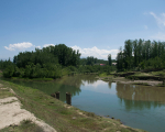
I crossed countless military checkpoints to finally reach Uri in Baramulla district. Ten kilometers from Uri, I was welcomed at the last destination of my project—the Kaman Post—with a road sign that read, ‘You are now under enemy country surveillance.’ Here, the Kaman Aman Setu on the Jhelum connects India to Azaad Kashmir, one of the three border crossings along the Line-of-Control. Usually a bustling transit hub, the custom offices at Kaman Post were empty, with no traffic across the bridge. The army officer accompanying me informed me that it had been closed for renovation and they were in no hurry to repair it, given the hostility between the two countries post-Pulwama. The mountains beyond the Kaman Aman Setu looked disconcertingly similar to the ones where I stood. Yet, they were out of bounds for Indians. Somewhere along the road, the muddy Jhelum at Srinagar had turned into a green cascade, roaring from the deep gorge below. This is the farthest I can go as a civilian, I thought to myself. Hundreds of feet below, the Jhelum has no such restrictions, as it thundered into Pakistan-Occupied-Kashmir, flowing further downstream into the plains of Punjab in Pakistan.
--------------------------------------------------
Looking back at my journey tracing the Jhelum, I can't help but accept the fact that the Jhelum no longer enjoys the exalted status it once had in the conscience of Kashmiris. It now make headlines only during catastrophic events like the flood of 2014 and its aftermath, which forced local people to turn their attention to the dying Jhelum. The rising bed of the Jhelum due to silting was identified as only one of the several factors responsible for the flood. The riverbed was dredged thereafter. Other safety measures like reforestation of the denuded hills to arrest soil erosion, or creation of new flood channels to counter the heavy damage caused by loss of the historic Doodhganga channel and the Mar Nallah (these were earlier filled up), have been discussed, but never executed. Removal of encroachment on the edge of the river, channels and lakes have translated on ground in haphazard actions. The urban sprawl taking over the wetlands of Bemina, Batmalo, etc., remains as unchecked now as it was before the floods.
Political turmoil and resultant bureaucratic apathy are often cited as the reasons behind this lack of prioritisation and action. One cannot help but notice the irony in this, given the fact that one of the key factors that make Kashmir of such strategic importance to India is its water resources. Even as India and Pakistan are often at loggerheads over the other’s violations of the Indus Water Treaty, the rivers that are actually brokered for the respective countries to control are ignored, their assets allowed to dwindle.
‘How long do you think the Jhelum will survive all this?’ I wondered out loud at my friendly boatmen.
Noor Mohammad Pakhdoomi smiled mysteriously. ‘The entire Valley can be brought to its knees,’ he said, ‘But the Jhelum will always have its own rules.’
Notes
[1] Wasim Bhat, ‘Captive City,’ in Until My Freedom Has Come: The New Intifada in Kashmir, ed. Sanjay Kak (New Delhi: Penguin, 2011).
[2] Ibid.
[3] The Gujjar and Bakharwals are pastoral nomads who travel with their flocks of sheep and goats between the hills of Kashmir and the plains of Jammu with the change of seasons.