
The archaeological site of Pattanam (N. Lat. 10°09.434’; E. Long. 76°12.587’) is located in Vadakkekara village of Paravur Taluk, about 25 km north of Kochi in the Ernakulum District of Kerala, India. This is a coastal site located in the delta of the Periyar River and is now about 4 km from the Arabian Sea coast. The Paravur Todu, presently a distributary of the Periyar, flows about 1 km south of the site, while the river Periyar itself flows about 5 km north of Pattanam. The site is surrounded by palaeo-channels, a backwater, lagoons and streams. Though the site is surrounded by marshy areas with saline water, the area of Pattanam has sweet water suitable for drinking, which may be one of the reasons for the location of an ancient settlement here.
The Pattanam mound reaches a height of 3.32 m above Mean Sea Level (MSL) and is spread out over about 111 hectares. However, the site is considerably disturbed as it is now occupied by a densely populated village. The Kerala Council for Historical Research (KCHR) presently owns about 5 acres of the site.
The eight seasons of excavations by the KCHR since 2007 have unearthed a large number and variety of local and non-local artefacts belonging to different cultural periods. The site was occupied for about three millennia beginning from roughly 1000 BCE with archaeological material affiliated to the Iron Age, the Early Historic, the Medieval and the Modern cultural periods. Most of the excavated material however belongs to the Early Historic period (3rd century BCE to 5th century CE).
The word ‘Pattinam’ has its origins in the Prakrit language, and means a ferry, a port site or a commercial place. The location of Pattanam, as well as the material evidence unearthed here, point to the possibility that Pattanam could have been an integral part of the port of Muciri Pattinam or Muziris, mentioned in Tamil Sangam and Greco-Roman literature. However, like all ports, Pattanam too would have had its links with the hinterland, some of which are mentioned in the Tamil texts. Let us see what the texts tell us about Pattanam.
Muziris in Tamil and Greco-Roman Texts
The poet Nakkīrar mentions that during the reign of the Cērā king Polantār-k-kuṭṭuvaṉ, residents of Muciṟi would sail in boats to fetch fish which they exchanged for paddy. The traders also used boats to bring goods from the ships anchored in the deep sea. Pepper was brought in bags to the port. These goods from the forest and sea were generously distributed by the king to guests (Puṟanāṉūṟu 343).
Pepper is a leitmotif in the Tamil texts wherever Muziris is mentioned. The poet Tāyaṅkaṇṇaṉār, in the Akananuru, describes Muciri on the bank of Cuḷḷiyam Pēriyāṟu:
In Chēran’s prosperous Muciṟi town, the huge
and beautiful Cuḷḷi river flows, muddied with
white foam. The Yavanas come with their
fine ships, bearing gold, and leave with pepper.
(Akanāṉūṟu 149, trans. Vaidehi Herbert)
The Periplus of the Erythraean Sea, an anonymous navigator’s account written in Greek belonging to the 1st century CE (translated by Lionel Casson, 1989), gives locational details for Muziris. ‘…Then come Naura and Tyndis, the first ports of trade of Limyrike, and, after these, Muziris and Nelkynda, which are now the active ones.’ Similarly, ‘Tyndis, a well-known village on the coast, is in the kingdom of Keprobotos. Muziris, in the same kingdom, owes its prosperity to the shipping from Ariake that comes there as well as to Greek shipping. It lies on a river 500 stades distant from Tyndis by river and sea, and from [?the river mouth] to it is 20 stades. Nelkynda is just about 500 stades from Muziris, likewise by river and sea, but it is in another kingdom, Pandion’s. It too lies on a river, about 120 stades from the sea.’
But what are of immense importance are the references to the kinds of goods that were traded to and from Muziris in the trade across the Arabian Sea. ‘Ships in these ports of trade carry full loads because of the volume and quantity of pepper and malabathron. They offer a market for: mainly a great amount of money; peridot(?); clothing with no adornment, in limited quantity; multicoloured textiles; sulphide of antimony; coral; raw glass; copper; tin; lead; wine, in limited quantity, as much as goes to Barygaza; realgar; orpiment; grain in sufficient amount for those involved in shipping, because the merchants do not use it. They export pepper, grown for the most part in only one place connected with these ports of trade, that called Kottanarike. They also export: good supplies of fine-quality pearls; ivory; Chinese [i.e., silk] cloth; Gangetic nard; malabathron, brought from the interior; all kinds of transparent gems; diamonds; sapphires; tortoise shell, both the kind from Chryse Island and the kind caught around the islands lying off Limyrike itself. For those sailing here from Egypt, the right time to set out is around the month of July, that is, Epeiph.’
The lack of safety in the waters around Muziris is mentioned by the Roman writer, Pliny the Elder (c. CE 77): “Thence from Ocelis [a Red Sea port] with the wind Hippalus they sail in forty days to Muziris the first emporium of India, not to be sought on account of the pirates in the neighbourhood.”
One of the most interesting documents is the Muziris Papyrus (dated 2nd century CE and now in the Vienna National Library), an agreement signed between two men, one whose cargo originated at Muziris on the Malabar Coast bound for Alexandria in Egypt. There are fascinating details regarding the rates of payment for transporting goods, duties to be paid at Alexandria and the entire process of ensuring the security of the goods being transported over sea and land.
The Archaeological Evidence for Trade
Both the Tamil and classical texts inform us regarding the importance of the trade to the Roman world. However, it is the archaeological evidence that gives us direct evidence of trade through objects that are considered non-local. At the same time, several materials, such as the semi-precious stones beryl and carnelian, and botanical products such as pepper, came from the hinterlands.
Pattanam, in fact, has given considerable evidence for the manufacturing of beads of semi-precious stones. Raw material nodules, debitage and beads in different stages of manufacture attest to the craft of bead making. While beads may have been used locally, it is also possible that these may have been exported out of Pattanam along with other objects of stone.
What seem to have been clearly made for non-local markets were half-finished artefacts like stone cameo blanks and ring-stones. Stones such as chalcedony, carnelian, crystal, quartz, beryl and agate were used to make objects such as cameo blanks that may have been finished and engraved with designs in the areas to which they were shipped.
Yet another material, glass, seems to have been destined for non-local consumption. Objects made from glass include beads, bangles, and various kinds of glassware and gaming counters. Among these, the largest category comprises the Indo-Pacific ‘trade-wind’ beads, which are small, monochrome (in green, blue, red and orange-red, black and yellow colours), and made using the drawn technology. Scholars have suggested that glass beads at Pattanam may have been sourced from the major glass bead producing centre in South India, Arikamedu, located on the east coast near Pondicherry.
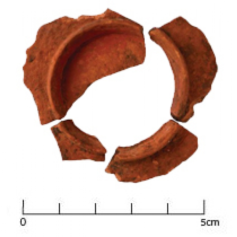
The ceramics found at Pattanam are an interesting mix of local and non-local. The former include Black and Red Ware, Fine Grey Ware, Indian Rouletted Ware and a type called Pattanam Ware, so far found only from Pattanam and Khor Rori in Oman. Non-local ceramics of various periods include varied kinds of amphorae (for wine and fish sauce), Torpedo Jars, Terra Sigillata, Turquoise Glazed Pottery (TGP), and Chinese porcelain. What were these non-local ceramics doing here? Some of these, such as amphorae and Torpedo Jars, were used to transport wines and sauces probably for local elites and foreign traders.
Like the ceramics, Pattanam too projects a mix of the local and the non-local. It essentially remained a Malabar coastal settlement, which looked both towards its hinterlands as well as outwards across the ocean. It was this mix that was sought to be projected at an exhibition at the National Museum, New Delhi, Unearthing Pattanam: Histories, Cultures, Crossings (28th November 2014 – 10th January 2015). The numerous iron and copper artefacts (to make tools, ornaments and coins), as well as those of stone (to make grinding stones and other tools) and terracotta (to make ornaments such as beads of various shapes; tools such as crucibles for melting metal or whorls for spinning thread; toys such as balls or marbles; and artefacts of unknown function such as discs) reflect the quotidian at Pattanam. The glassware, beads of stone and glass, and ceramics illustrate the long-distance links of the site. Among the prized exhibits are two carnelian intaglios, one with the image of Fortuna engraved on it and the other, one of a leaping lion, both of which showcase the use of a local material with non-local motifs. Another exhibit, a miniature model of an axe, made in gold, also highlights the use of a precious metal to make a familiar object, an axe hafted with cross-bands, very much like those full-size examples of iron that are common to Iron Age sites in South India.
One of the aims of the exhibition was to highlight Pattanam as an archaeological site, in other words, to showcase the process of excavation in archaeology. While museum exhibits are often sourced from archaeological sites, all too often there is little understanding among viewers how artefacts were retrieved from under the earth. This was sought to be elucidated by reproducing in photographs an actual trench, displayed with the tools of excavation, as also showing on the ‘excavation wall’ each process of the excavation whereby artefacts were recovered, documented, analyzed, conserved and ultimately published and stored. Archaeological sites are dated through identifiable material found in stratigraphic layers, as well as through scientific techniques such as radiocarbon dating. Because Pattanam is a heavily occupied and hence disturbed site, the stratigraphy is less secure. However, much of the excavated material is stylistically dateable and hence provides us with a chronology for the site, as do the radiocarbon and AMS dates.
Was Pattanam the fabled Muziris? This issue is still a matter of conjecture, with some scholars preferring Cranganore (or Kodungallur), about 8 kms away from Pattanam, on the Periyar, as the true location of Muziris. However, limited excavations at Kodungallur have not produced evidence of pre-medieval occupation. A late Roman map, the Tabula Peutingeriana, dated to the 5th century CE, in fact shows on its eastern edge Muziris, as also a Temple of Augustus. A place called Cotiara is probably the Kottanarike mentioned in the Periplus. Interestingly, the map also shows a place inland from Muziris called Patinae, a name very similar to the present Pattanam. However, even if the archaeological site of Pattanam was not the Muziris of the texts, the material evidence recovered from this site clearly suggests long-distance trans-oceanic contacts. From that point of view, Pattanam remains at present a significant Early Historic site on the Malabar Coast.